Ward: Dichtstbijzijnde stranden - 3 binnen 18 km
Dorp, Regio Marlborough, Nieuw-Zeeland
Belangrijkste functies: Wild strand, Goed voor surfen, Kamperen toegestaan
Bekijk 3 stranden op de kaart
De kaartweergave toont meer stranden, hotelprijzen in de buurt, en filters voor strandtype, ondergrond, drukte en voorzieningen.
Open de kaart
Zoekstraal
Straal wijzigen
Alle stranden binnen 18 km vanaf centrum
Toont 3 van 3
binnen 18 km
Ontspanning
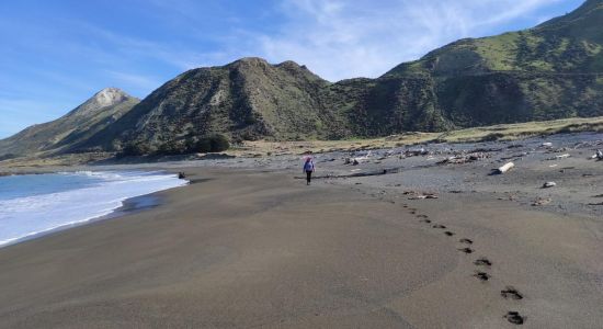
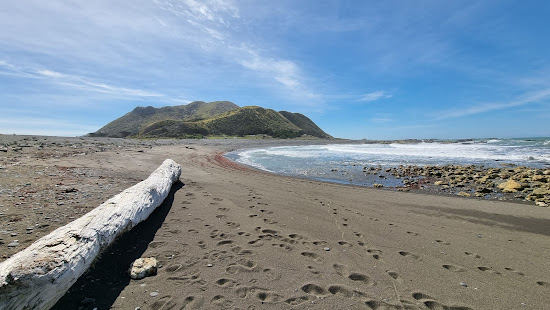
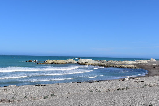
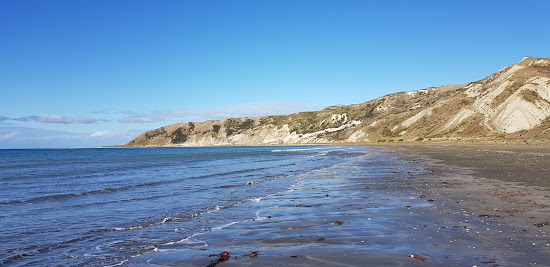
Ward Beach
4.3 km vanaf het centrum van Ward
Uitstekend
67 recensies
9.4
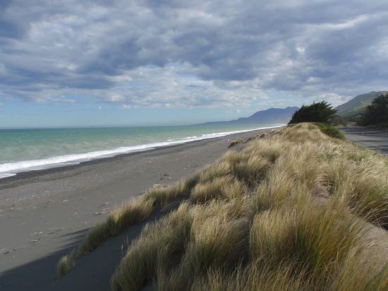
Kleine grijze kiezels
Goed voor surfen
Natuurlijke strand (geen voorzieningen)
Troebel turkoois water
Goed om te zwemmen
Zand- en rotsachtige zeebodem

We komen hier vaak omdat we 40 minuten verderop wonen. De hele familie houdt van dit gebied en het is een geweldige daguitstap voor ons. Neem een picknick mee! Omdat vuur normaal gesproken op dit tijdstip van het jaar (zomer) in dit gebied - en een groot deel van NZ - verboden is, weet ik niet of je een BBQ kunt gebruiken. Er is een leuk café aan de hoofdweg in Ward, met toiletten, een tankstation en een grote parkeerplaats.

Wees voorzichtig op de weg ernaartoe. Er is een "veestop" die je niet waarschuwt voor de optimale snelheid om deze over te steken. Ik zou de laagste snelheid aanbevelen, want het is veel erger dan een verkeersdrempel. We kwamen ook een schaap op de weg tegen met haar 2 lammetjes en ze hadden moeite om uit de weg te komen, dus neem extra voorzichtigheid in acht voor willekeurige dieren. Het strand is zeer rotsachtig en het kan winderig zijn, maar al met al prachtig.

Ontspanning
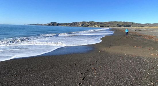
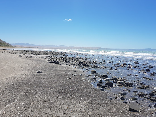
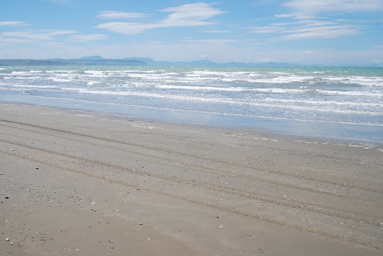
Marfell's Beach
12.5 km vanaf het centrum van Ward
Uitstekend
75 recensies
8.8
Kleine bruine kiezels
Troebel turkoois water
Goed om te zwemmen
Watersokken noodzakelijk
Zand- en rotsachtige zeebodem
Groot getijdengebied

Einar Schmidt
Beginnende strandganger
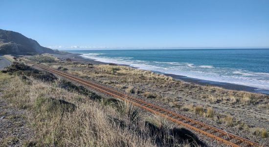
On November 14, 2016, a magnitude 7.8 earthquake struck the east coast of New Zealand's South Island. With a depth of just 15km, the quake was felt across the country and was the second most powerful in New Zealand's history, surpassed only by the magnitude 8.2 earthquake that hit Wairarapa in 1855. The quake generated a tsunami with waves up to 10 meters high in Cook Strait, and a newly exposed strip of shoreline between Wellington and the Hutt Valley provided a safe road and railway route, making previously impassable coastal roads accessible at high tide.
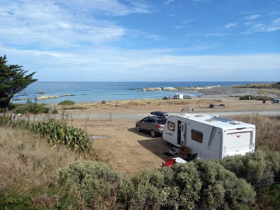
A similar phenomenon occurred at Marfell's Beach scenic walk to the lighthouse, a popular 6km trail that takes about 90 minutes to complete. The Marfells Beach-Cape Campbell walk is an unmarked route that follows the beach from the Marfells Beach camping ground to Cape Campbell, the southernmost tip of Cook Strait.
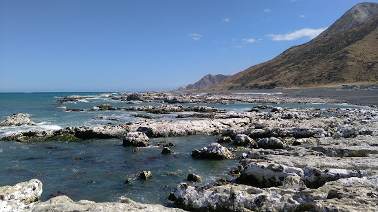
Before the November 2016 Kaikoura earthquake, access to Cape Campbell required careful timing with low tide. However, the earthquake caused significant uplift, making the beach walk more accessible and less dependent on the tides. It is still wise to check weather conditions before setting out.
The turnoff to Marfells Beach is about 36 kilometers south of Blenheim, with the beach located a further 8km along a mostly sealed road.
Cook Strait is known as one of the world's roughest stretches of water, part of the westerly wind belt called the Roaring Forties. This has led to numerous shipwrecks in the 19th century. The average ocean depth of Cook Strait is about 128 meters.
Between 1845 and 1947, 19 ships met their fate along this east coast stretch. The earthquake uplift has revealed numerous rocks and reefs, explaining the perilous conditions.
The lighthouse is located at the southernmost extreme of Cook Strait. Marfells Beach features a DOC camping ground, which is quite popular. This area is one of the sunniest places in New Zealand, so visitors can expect excellent weather.
Nearby, as you drive into Marfell's Beach, you'll see the local salt factory. Taking advantage of Marlborough’s low rainfall, the Dominion Salt company has been producing salt here since 1942, generating over 70,000 tonnes of sea salt annually.
While there are no public tours or sales at the saltworks, you can view the evaporation ponds and
Sara Linn
Beginnende strandganger
Fantastische locatie direct aan het strand. Toegankelijk voor quad bikes. Zachte branding. Je kunt in één richting naar de oude kade lopen en in de andere richting naar de punt. Schone faciliteiten en schaduwrijke plekken met bomen.

Ontspanning
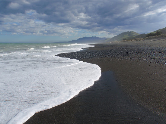
Black sand Beach
18.2 km vanaf het centrum van Ward
Uitstekend
29 recensies
9
Bruin zand
Natuurlijke strand (geen voorzieningen)
Zanderige zeebodem
Troebel turkoois water
Goed om te zwemmen
Niet parkeren


Nog onzeker?
Gebruik de strandkaart om te filteren op:
- Zand of kiezels
- Rustig of levendig
- Parkeren en bereikbaarheid...
- Openbaar strand of beachclub
- Loopafstand
Actieve filters:
Alles resetten
Beste stranden
Toont 3 van 3
binnen 18 km
Ontspanning
Ward Beach
4.3 km vanaf het centrum van Ward
Uitstekend
67 recensies
9.4
Kleine grijze kiezels
Goed voor surfen
Natuurlijke strand (geen voorzieningen)
Troebel turkoois water
Goed om te zwemmen
Zand- en rotsachtige zeebodem
We komen hier vaak omdat we 40 minuten verderop wonen. De hele familie houdt van dit gebied en het is een geweldige daguitstap voor ons. Neem een picknick mee! Omdat vuur normaal gesproken op dit tijdstip van het jaar (zomer) in dit gebied - en een groot deel van NZ - verboden is, weet ik niet of je een BBQ kunt gebruiken. Er is een leuk café aan de hoofdweg in Ward, met toiletten, een tankstation en een grote parkeerplaats.
Wees voorzichtig op de weg ernaartoe. Er is een "veestop" die je niet waarschuwt voor de optimale snelheid om deze over te steken. Ik zou de laagste snelheid aanbevelen, want het is veel erger dan een verkeersdrempel. We kwamen ook een schaap op de weg tegen met haar 2 lammetjes en ze hadden moeite om uit de weg te komen, dus neem extra voorzichtigheid in acht voor willekeurige dieren. Het strand is zeer rotsachtig en het kan winderig zijn, maar al met al prachtig.
Ontspanning
Marfell's Beach
12.5 km vanaf het centrum van Ward
Uitstekend
75 recensies
8.8
Kleine bruine kiezels
Troebel turkoois water
Goed om te zwemmen
Watersokken noodzakelijk
Zand- en rotsachtige zeebodem
Groot getijdengebied
Einar Schmidt
Beginnende strandganger
On November 14, 2016, a magnitude 7.8 earthquake struck the east coast of New Zealand's South Island. With a depth of just 15km, the quake was felt across the country and was the second most powerful in New Zealand's history, surpassed only by the magnitude 8.2 earthquake that hit Wairarapa in 1855. The quake generated a tsunami with waves up to 10 meters high in Cook Strait, and a newly exposed strip of shoreline between Wellington and the Hutt Valley provided a safe road and railway route, making previously impassable coastal roads accessible at high tide.
A similar phenomenon occurred at Marfell's Beach scenic walk to the lighthouse, a popular 6km trail that takes about 90 minutes to complete. The Marfells Beach-Cape Campbell walk is an unmarked route that follows the beach from the Marfells Beach camping ground to Cape Campbell, the southernmost tip of Cook Strait.
Before the November 2016 Kaikoura earthquake, access to Cape Campbell required careful timing with low tide. However, the earthquake caused significant uplift, making the beach walk more accessible and less dependent on the tides. It is still wise to check weather conditions before setting out.
The turnoff to Marfells Beach is about 36 kilometers south of Blenheim, with the beach located a further 8km along a mostly sealed road.
Cook Strait is known as one of the world's roughest stretches of water, part of the westerly wind belt called the Roaring Forties. This has led to numerous shipwrecks in the 19th century. The average ocean depth of Cook Strait is about 128 meters.
Between 1845 and 1947, 19 ships met their fate along this east coast stretch. The earthquake uplift has revealed numerous rocks and reefs, explaining the perilous conditions.
The lighthouse is located at the southernmost extreme of Cook Strait. Marfells Beach features a DOC camping ground, which is quite popular. This area is one of the sunniest places in New Zealand, so visitors can expect excellent weather.
Nearby, as you drive into Marfell's Beach, you'll see the local salt factory. Taking advantage of Marlborough’s low rainfall, the Dominion Salt company has been producing salt here since 1942, generating over 70,000 tonnes of sea salt annually.
While there are no public tours or sales at the saltworks, you can view the evaporation ponds and
Sara Linn
Beginnende strandganger
Fantastische locatie direct aan het strand. Toegankelijk voor quad bikes. Zachte branding. Je kunt in één richting naar de oude kade lopen en in de andere richting naar de punt. Schone faciliteiten en schaduwrijke plekken met bomen.
Ontspanning
Black sand Beach
18.2 km vanaf het centrum van Ward
Uitstekend
29 recensies
9
Bruin zand
Natuurlijke strand (geen voorzieningen)
Zanderige zeebodem
Troebel turkoois water
Goed om te zwemmen
Niet parkeren
Nog onzeker?
Gebruik de strandkaart om te filteren op:
- Zand of kiezels
- Rustig of levendig
- Parkeren en bereikbaarheid...
- Openbaar strand of beachclub
- Loopafstand