Ward: Najbliższe plaże - 3 w promieniu 18 km
Wieś, Region Marlborough, Nowa Zelandia
Kluczowe funkcje: Dzika plaża, Dobry do surfowania, Kemping dozwolony
Zobacz 3 plaże na mapie
Widok mapy zawiera więcej plaż, ceny pobliskich hoteli oraz filtry rodzaju plaży, podłoża, zatłoczenia i udogodnień.
Otwórz mapę
Promień wyszukiwania
Zmień promień
Wszystkie plaże w promieniu 18 km od centrum
Wyświetlanie 3 z 3
w promieniu 18 km
Relaks
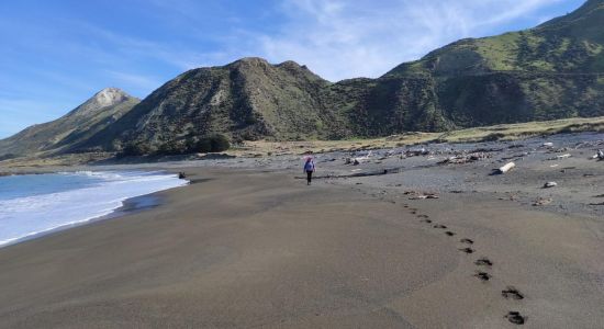
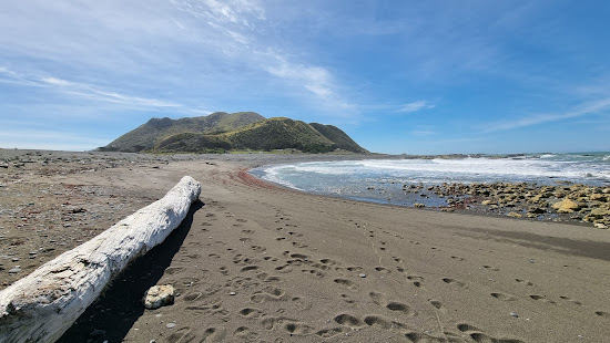
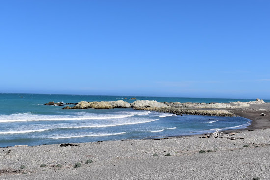
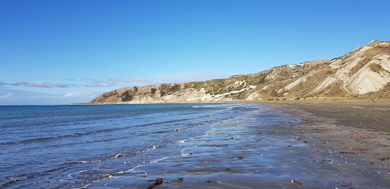
Ward Beach
4.3 km od centrum Ward
Doskonały
67 recenzji
9.4
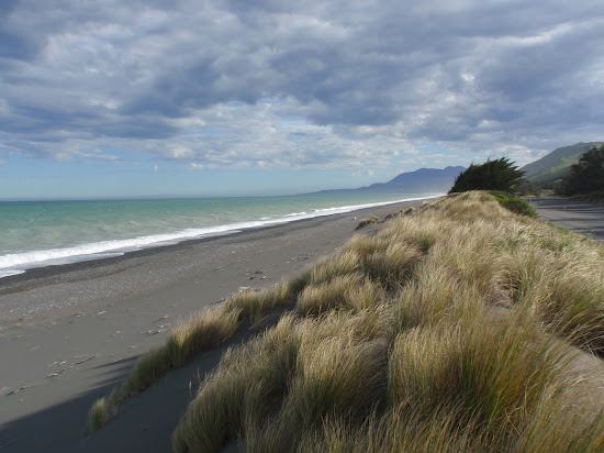
Małe szare kamyczki
Dobry do surfowania
Naturalna plaża (bez udogodnień)
Mętna turkusowa woda
Pływanie jest dobre
Piaszczysto-skaliste dno morskie

Przychodzimy tutaj często, ponieważ mieszkamy 40 minut stąd. Cała rodzina to uwielbia i to świetny dzień dla nas.
Weźcie ze sobą piknik!
Ponieważ ogniska są zazwyczaj zabronione o tej porze roku (latem) w tym rejonie - i dużej części NZ - nie jestem pewien, czy można używać grilla.
Na głównej drodze w Ward jest piękna kawiarnia, z toaleta, stacją benzynową i dużym parkingiem.

Bądź ostrożny na drodze tam. Jest tam "bariera bydła", która nie informuje o optymalnej prędkości do jej przekroczenia. Polecam najniższą możliwą prędkość, ponieważ jest znacznie gorsza niż spowolnienie. Napotkałem również owcę na drodze z jej dwójką młodych i miały trudności z zejściem z drogi, więc zachowaj dodatkową ostrożność dla przypadkowych zwierząt. Plaża jest bardzo kamienista i może być wietrzna, ale ogólnie piękna

Relaks
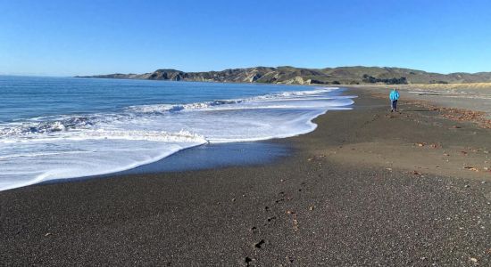
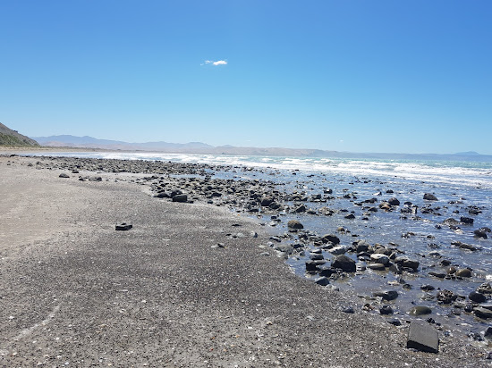
Marfell's Beach
12.5 km od centrum Ward
Doskonały
75 recenzji
8.8
Małe brązowe kamyczki
Mętna turkusowa woda
Pływanie jest dobre
Skarpety wodne konieczne
Piaszczysto-skaliste dno morskie
Duży obszar pływów

Einar Schmidt
Nieznający się na plażowaniu
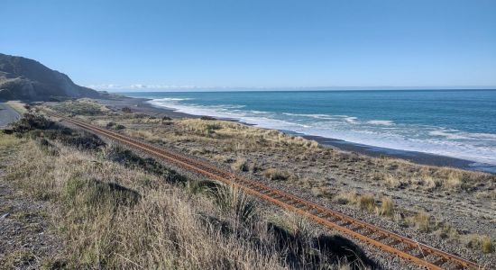
On November 14, 2016, a magnitude 7.8 earthquake struck the east coast of New Zealand's South Island. With a depth of just 15km, the quake was felt across the country and was the second most powerful in New Zealand's history, surpassed only by the magnitude 8.2 earthquake that hit Wairarapa in 1855. The quake generated a tsunami with waves up to 10 meters high in Cook Strait, and a newly exposed strip of shoreline between Wellington and the Hutt Valley provided a safe road and railway route, making previously impassable coastal roads accessible at high tide.
A similar phenomenon occurred at Marfell's Beach scenic walk to the lighthouse, a popular 6km trail that takes about 90 minutes to complete. The Marfells Beach-Cape Campbell walk is an unmarked route that follows the beach from the Marfells Beach camping ground to Cape Campbell, the southernmost tip of Cook Strait.
Before the November 2016 Kaikoura earthquake, access to Cape Campbell required careful timing with low tide. However, the earthquake caused significant uplift, making the beach walk more accessible and less dependent on the tides. It is still wise to check weather conditions before setting out.
The turnoff to Marfells Beach is about 36 kilometers south of Blenheim, with the beach located a further 8km along a mostly sealed road.
Cook Strait is known as one of the world's roughest stretches of water, part of the westerly wind belt called the Roaring Forties. This has led to numerous shipwrecks in the 19th century. The average ocean depth of Cook Strait is about 128 meters.
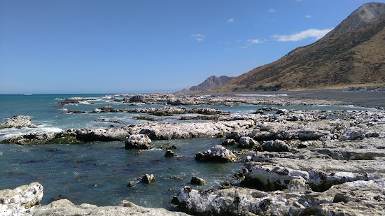
Between 1845 and 1947, 19 ships met their fate along this east coast stretch. The earthquake uplift has revealed numerous rocks and reefs, explaining the perilous conditions.
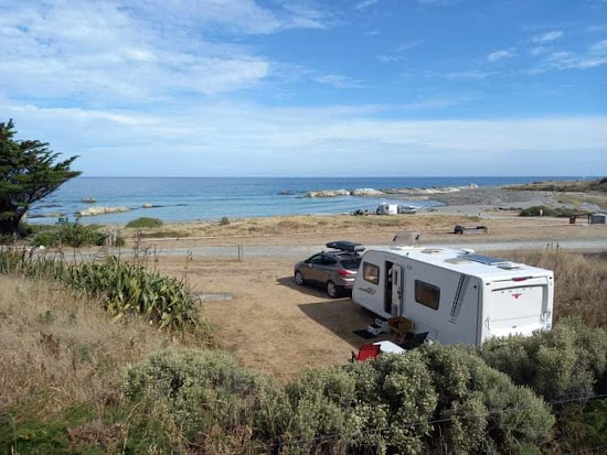
The lighthouse is located at the southernmost extreme of Cook Strait. Marfells Beach features a DOC camping ground, which is quite popular. This area is one of the sunniest places in New Zealand, so visitors can expect excellent weather.
Nearby, as you drive into Marfell's Beach, you'll see the local salt factory. Taking advantage of Marlborough’s low rainfall, the Dominion Salt company has been producing salt here since 1942, generating over 70,000 tonnes of sea salt annually.
While there are no public tours or sales at the saltworks, you can view the evaporation ponds and
Sara Linn
Nieznający się na plażowaniu
Fantastyczna lokalizacja tuż przy plaży. Dostępna dla quadów. Łagodna fala. Możesz iść w kierunku starego pomostu w jednym kierunku i do cypla w drugim. Czyste udogodnienia i zacienione miejsca z drzewami.

Relaks
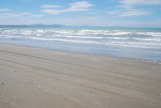
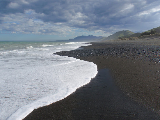
Black sand Beach
18.2 km od centrum Ward
Doskonały
29 recenzji
9
Brązowy piasek
Naturalna plaża (bez udogodnień)
Piaszczyste dno morskie
Mętna turkusowa woda
Pływanie jest dobre
Nie parkować


Trudny wybór?
Użyj mapy plaż, aby filtrować według:
- Piasek czy kamienie
- Spokój czy rozrywka
- Parking i dojazd...
- Plaża publiczna czy klub plażowy
- Dystans pieszy
Aktywne filtry:
Zresetuj wszystko
Najlepsze plaże
Wyświetlanie 3 z 3
w promieniu 18 km
Relaks
Ward Beach
4.3 km od centrum Ward
Doskonały
67 recenzji
9.4
Małe szare kamyczki
Dobry do surfowania
Naturalna plaża (bez udogodnień)
Mętna turkusowa woda
Pływanie jest dobre
Piaszczysto-skaliste dno morskie
Przychodzimy tutaj często, ponieważ mieszkamy 40 minut stąd. Cała rodzina to uwielbia i to świetny dzień dla nas.
Weźcie ze sobą piknik!
Ponieważ ogniska są zazwyczaj zabronione o tej porze roku (latem) w tym rejonie - i dużej części NZ - nie jestem pewien, czy można używać grilla.
Na głównej drodze w Ward jest piękna kawiarnia, z toaleta, stacją benzynową i dużym parkingiem.
Bądź ostrożny na drodze tam. Jest tam "bariera bydła", która nie informuje o optymalnej prędkości do jej przekroczenia. Polecam najniższą możliwą prędkość, ponieważ jest znacznie gorsza niż spowolnienie. Napotkałem również owcę na drodze z jej dwójką młodych i miały trudności z zejściem z drogi, więc zachowaj dodatkową ostrożność dla przypadkowych zwierząt. Plaża jest bardzo kamienista i może być wietrzna, ale ogólnie piękna
Relaks
Marfell's Beach
12.5 km od centrum Ward
Doskonały
75 recenzji
8.8
Małe brązowe kamyczki
Mętna turkusowa woda
Pływanie jest dobre
Skarpety wodne konieczne
Piaszczysto-skaliste dno morskie
Duży obszar pływów
Einar Schmidt
Nieznający się na plażowaniu
On November 14, 2016, a magnitude 7.8 earthquake struck the east coast of New Zealand's South Island. With a depth of just 15km, the quake was felt across the country and was the second most powerful in New Zealand's history, surpassed only by the magnitude 8.2 earthquake that hit Wairarapa in 1855. The quake generated a tsunami with waves up to 10 meters high in Cook Strait, and a newly exposed strip of shoreline between Wellington and the Hutt Valley provided a safe road and railway route, making previously impassable coastal roads accessible at high tide.
A similar phenomenon occurred at Marfell's Beach scenic walk to the lighthouse, a popular 6km trail that takes about 90 minutes to complete. The Marfells Beach-Cape Campbell walk is an unmarked route that follows the beach from the Marfells Beach camping ground to Cape Campbell, the southernmost tip of Cook Strait.
Before the November 2016 Kaikoura earthquake, access to Cape Campbell required careful timing with low tide. However, the earthquake caused significant uplift, making the beach walk more accessible and less dependent on the tides. It is still wise to check weather conditions before setting out.
The turnoff to Marfells Beach is about 36 kilometers south of Blenheim, with the beach located a further 8km along a mostly sealed road.
Cook Strait is known as one of the world's roughest stretches of water, part of the westerly wind belt called the Roaring Forties. This has led to numerous shipwrecks in the 19th century. The average ocean depth of Cook Strait is about 128 meters.
Between 1845 and 1947, 19 ships met their fate along this east coast stretch. The earthquake uplift has revealed numerous rocks and reefs, explaining the perilous conditions.
The lighthouse is located at the southernmost extreme of Cook Strait. Marfells Beach features a DOC camping ground, which is quite popular. This area is one of the sunniest places in New Zealand, so visitors can expect excellent weather.
Nearby, as you drive into Marfell's Beach, you'll see the local salt factory. Taking advantage of Marlborough’s low rainfall, the Dominion Salt company has been producing salt here since 1942, generating over 70,000 tonnes of sea salt annually.
While there are no public tours or sales at the saltworks, you can view the evaporation ponds and
Sara Linn
Nieznający się na plażowaniu
Fantastyczna lokalizacja tuż przy plaży. Dostępna dla quadów. Łagodna fala. Możesz iść w kierunku starego pomostu w jednym kierunku i do cypla w drugim. Czyste udogodnienia i zacienione miejsca z drzewami.
Relaks
Black sand Beach
18.2 km od centrum Ward
Doskonały
29 recenzji
9
Brązowy piasek
Naturalna plaża (bez udogodnień)
Piaszczyste dno morskie
Mętna turkusowa woda
Pływanie jest dobre
Nie parkować
Trudny wybór?
Użyj mapy plaż, aby filtrować według:
- Piasek czy kamienie
- Spokój czy rozrywka
- Parking i dojazd...
- Plaża publiczna czy klub plażowy
- Dystans pieszy