South Benfleet: Najbliższe plaże - 8 w promieniu 17 km
Wieś, Hrabstwo Essex, Anglia, Wielka Brytania
Kluczowe funkcje: Dzika plaża, Dobry do kajakarstwa, Latawiec lub windsurfing
Zobacz 8 plaż na mapie
Widok mapy zawiera więcej plaż, ceny pobliskich hoteli oraz filtry rodzaju plaży, podłoża, zatłoczenia i udogodnień.
Otwórz mapę
Promień wyszukiwania
Zmień promień
Wszystkie plaże w promieniu 17 km od centrum
Wyświetlanie 8 z 8
w promieniu 17 km

Relaks
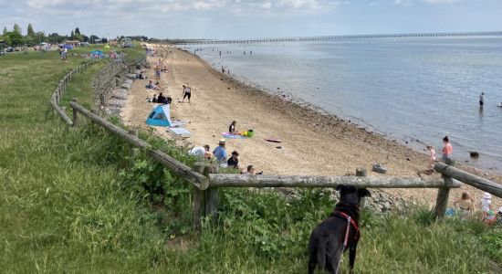
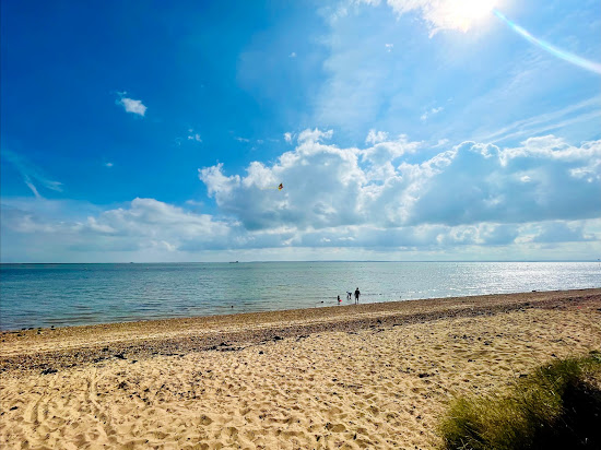
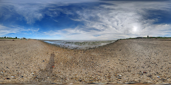
Plaża Shoebury East
17.3 km od centrum South Benfleet
Doskonały
449 recenzji
9
Idealny do pływania
Naturalna plaża (bez udogodnień)
Latawiec lub windsurfing
Beżowy piasek i kamyki
Piaszczysto-kamieniste dno morskie
Zatłoczony

Cass R.
Nieznający się na plażowaniu
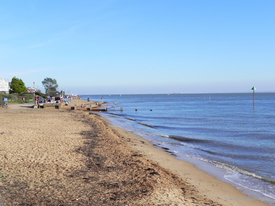
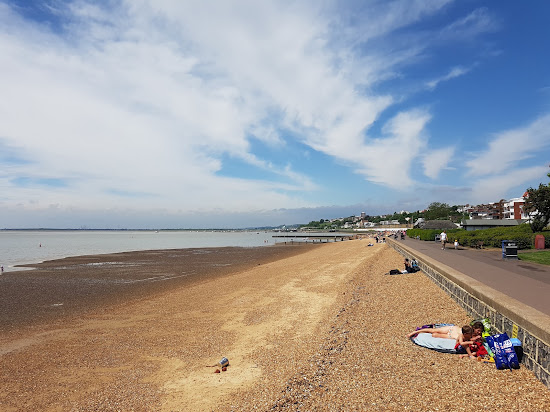
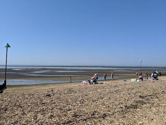
Wczoraj pojechaliśmy na plażę Shoebury East i świetnie się bawiliśmy. Plaża ma jasny piasek z kamieniami, co dodaje do ogólnego wrażenia.

Jaxon Hammerstein
Nieznający się na plażowaniu
Plaża jest oszałamiająca, a tuż przed nią znajduje się urocze pole, co czyni to idealnym miejscem na spokojny spacer z twoim futrzanym przyjacielem.

Relaks
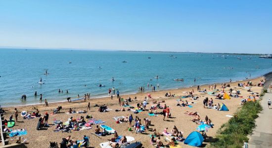
Plaża Chalkwell
8.2 km od centrum South Benfleet
Doskonały
414 recenzji
8.8
Naturalna plaża (bez udogodnień)
Dobry do surfowania na desce SUP
Chroniony przed falami
Beżowy piasek i kamyki
Duży obszar pływów
Zatłoczony

Nathan Rand
Nieznający się na plażowaniu
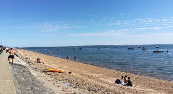
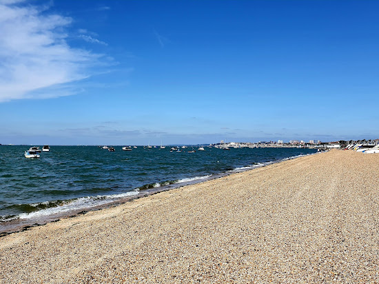
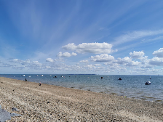
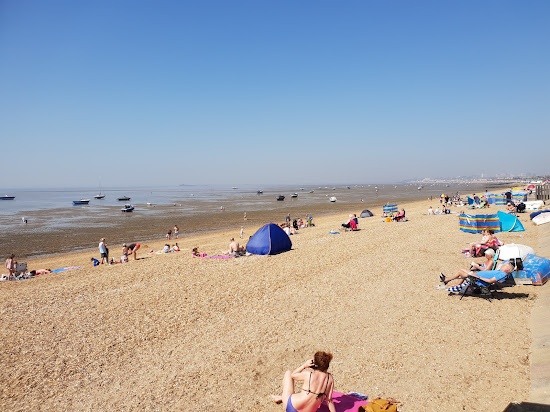
这个令人惊叹的海滩提供免费、方便的洗手间,并且靠近主要火车站,非常适合所有人。海滩本身非常友好和洁净,氛围宜人。此外,该地区还有各种海滨餐厅提供美味的海鲜菜肴。我强烈推荐这个海滩,一定不要错过从海岸上欣赏的惊人日落。

Mimo że plaża była miła, niestety toalety pozostawiały wiele do życzenia, bardzo zaniedbane. Toaleta przy dworcu śmierdziała moczem, to nie było ładne w ogóle. To drugi raz tutaj i ten sam rezultat co ostatnim razem, potrzebna jest lepsza konserwacja tych toalet.

Relaks
Shoebury beach
15.3 km od centrum South Benfleet
Doskonały
656 recenzji
8.8
Małe beżowe kamyki
Dno morskie z małymi kamyczkami
Chroniony przed falami
Latawiec lub windsurfing
Plaża z udogodnieniami
Zatłoczony

Asteria Starlyn.
Nieznający się na plażowaniu
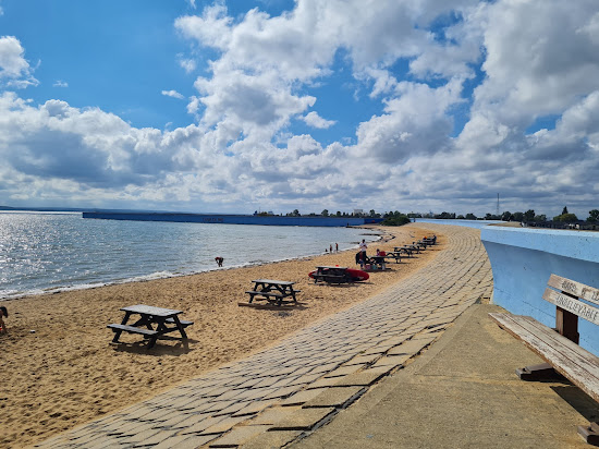
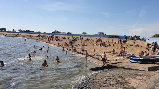
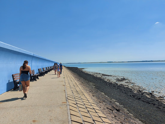
Jeśli szukasz wspaniałego miejsca do odpoczynku nad oceanem, ta plaża jest koniecznym miejscem do odwiedzenia. Chociaż nie jest piaszczysta, obfitość muszli i kamieni sprawia, że jest to ekscytujące miejsce do eksploracji zarówno dla dzieci, jak i dorosłych. Nie możesz przegapić lodów z wózka Wujka Toma - to przysmak, którego każdy odwiedzający powinien spróbować. Plaża ma wiele jaskrawo kolorowych chat, a w późnym popołudniu jest uroczo spokojna. Jest także przestronny parking, który pobiera bardzo niską opłatę, ale pamiętaj, aby zwrócić uwagę na godzinę zamknięcia. Warto zauważyć, że psy nie są dozwolone na plaży od maja do września.

Fantastyczne miejsce, jeśli chcesz spędzić czas obok 🌊 morza. Plaża nie jest piaszczysta, ale muszle i kamienie sprawiają, że wszystko jest bardziej ekscytujące zarówno dla dorosłych, jak i dzieci do odkrywania. Jest lody od wujka Toma, które są obowiązkowe dla każdego turysty. Jest wiele kolorowych domków plażowych i spokojnie cicho w późnych popołudniach. Jest przestronny parking, który nie jest drogi, jednak trzeba uważać na godzinę zamknięcia. Psy nie są dozwolone na plaży od maja do września.

Relaks
Thorney Bay Beach
4.7 km od centrum South Benfleet
Doskonały
848 recenzji
8.6
Mętna turkusowa woda
Dobry do kajakarstwa
Pływanie jest dobre
Beżowy piasek
Duży obszar pływów
Zatłoczony

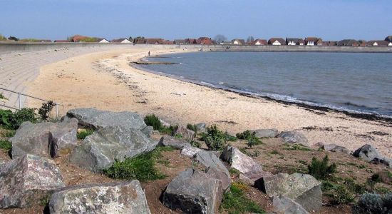
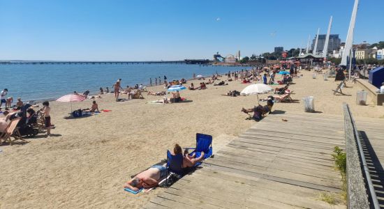
Miła mała plaża z placem zabaw dla dzieci. Świetna do spacerów z psami i na jednodniowe wycieczki.

Informacje w sieci podawały, że miejsce jest przyjazne psom. Niestety, w okresie letnim psy nie są dozwolone na plaży.
Plaża była zaśmiecona wszędzie. Na promenadzie w niektórych miejscach były odłamki szkła, co czyniło spacery z moimi psami niebezpiecznymi.
Kosze były przepełnione śmieciami.
Całkowita strata czasu, w mokrej i nieprzyjemnej okolicy.


Relaks
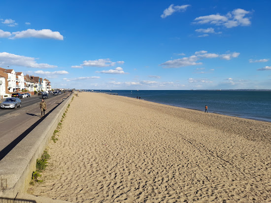
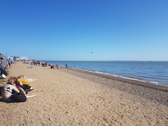
Plaża Jubileuszowa
11.8 km od centrum South Benfleet
Doskonały
2524 recenzji
8.6
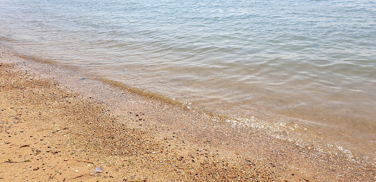
Mętna turkusowa woda
Małe beżowe kamyki
Dno morskie z małymi kamyczkami
Dobry do surfowania na desce SUP
Latawiec lub windsurfing
Bardzo zatłoczony

Fajna mała plaża w Southend-on-Sea!! Cudowny spacer po plaży z kubkiem kawy i przyjaciółmi. Znakomita pogoda. Miejsce, które trzeba odwiedzić dla spokojnego widoku wody i statków/ łodzi. Twórcy filmów na Instagramie na pewno pokochają to miejsce!!

Relaks
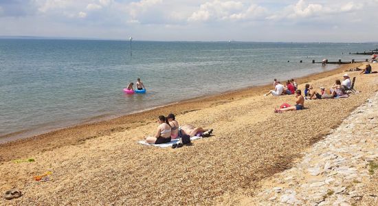
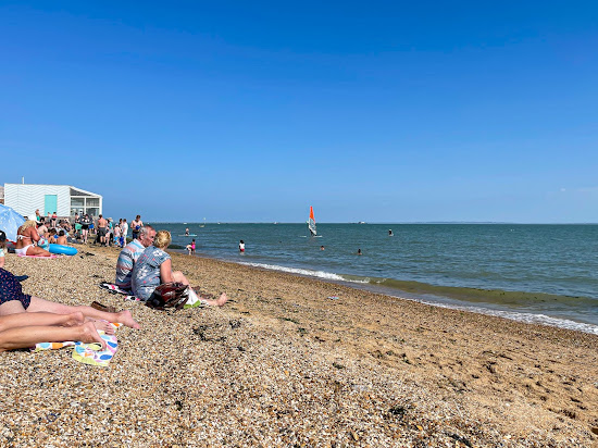
Westcliff beach
9.7 km od centrum South Benfleet
Doskonały
159 recenzji
8.8
Dobry do kajakarstwa
Chroniony przed falami
Plaża z udogodnieniami
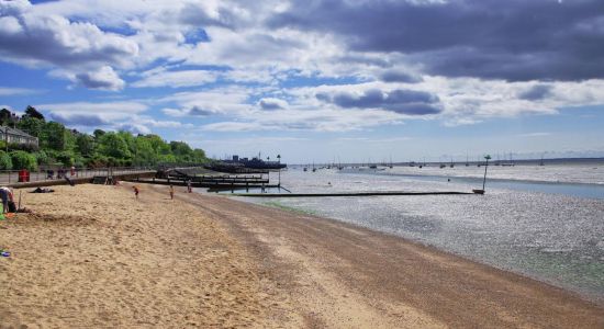
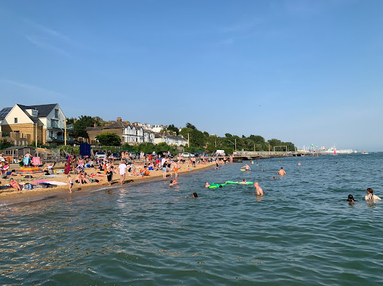
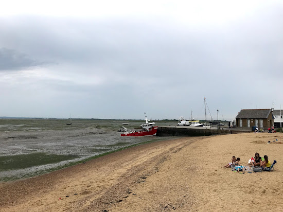
Beżowy piasek i kamyki
Duży obszar pływów
Zatłoczony

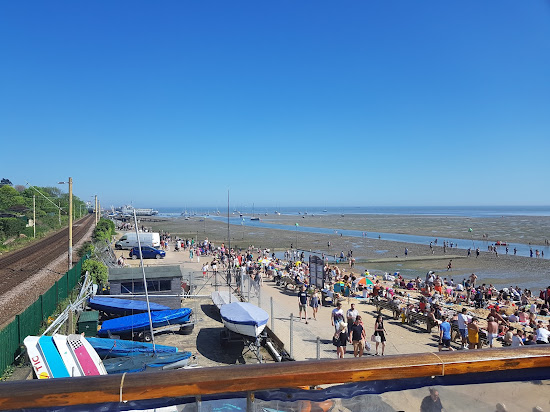
The tide was completely out, a lot of clay, actual beach area is quite narrow with pebbles and sand, when the tide eventually came in it didn't stop, eventually everyone had to get off the beach as it ended up completely submerged, that's nature for you.
Lots of food and drink around, places to buy bucket and spade, that kinda thing, water was calm, not the clearest but this ain't the Maldives. 🤷🏿♂️

Cała trasa nadmorska od Leigh on Sea do Southend przez Westcliff to musi być ,, spokojne i przytulne kawiarenki, ciepli ludzie z psem .. urocze plaże i fale i
Relaks
Bell Wharf beach
6.9 km od centrum South Benfleet
Bardzo dobry
147 recenzji
8.4
Plaża z udogodnieniami
Beżowy piasek i kamyki
Piaszczysto-kamieniste dno morskie
Szerokość - Bardzo wąska
Plaża publiczna
Zatłoczony

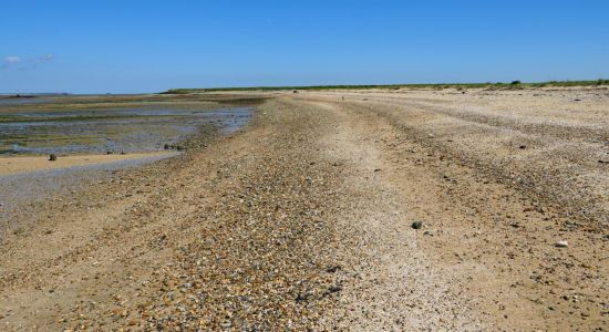
Urocza mała wieś rybacka z dobrymi połączeniami komunikacyjnymi, wysokiej jakości opcjami restauracyjnymi, spacerowym wybrzeżem, w tym dostępem do plaży Bell Wharf i imponującą aktywnością przypływów. Można zobaczyć wodę na horyzoncie oddaloną o 2 mile, a kilka godzin później masz 5,5 metra głębokiej wody tuż przed sobą.

Ethan Harrington
Nieznający się na plażowaniu
Ten uroczy nadmorski miasteczko emanuje urokiem tradycyjnej wioski rybackiej, z mnóstwem kuszących barów i restauracji do odkrycia. Chociaż nie udało nam się zobaczyć oceanu z powodu przypływu, nasze małe dzieci były zachwycone pluskaniem się w małym basenie morskim znajdującym się tuż przy plaży. Warto zauważyć, że parkowanie może być tu trochę wyzwaniem, ponieważ dostępnych jest niewiele miejsc, a należy pamiętać o opłacie za godzinę parkowania w wysokości jednego funta. Pomimo tych drobnych niedogodności, z całego serca polecamy odwiedzenie tego uroczego miejsca.

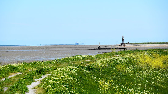
Relaks
Plaża Yantlet
12 km od centrum South Benfleet
Bardzo dobry
28 recenzji
8.2
Plaża publiczna
Naturalna plaża (bez udogodnień)
Łatwy dostęp
Beżowy piasek i kamyki
Mętna turkusowa woda
Duży obszar pływów

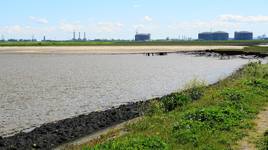
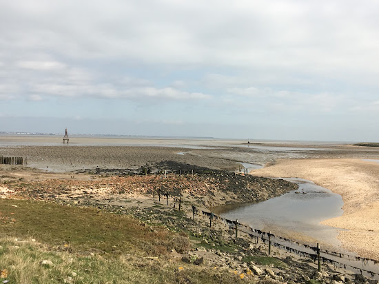
Wyglądało wspaniale, ale nie mogłem właściwie dotrzeć na plażę, ponieważ przypływ nadchodził. Idź tylko przy bardzo niskim stanie wody!
Ogromna, rozległa, izolowana plaża, tak nieoczekiwana. Jest również piaszczysta, a nie błotnista jak w estuarium Tamizy. Wrócę przy niskim stanie wody i będę ostrożny, aby nie zostać odciętym.

Pip
Nieznający się na plażowaniu
Szedłem z Allhallows w słoneczny dzień. Odpływ się skończył, co ułatwiło przejście Yantlet Creek na plażę. Nie jest jasne, czy jest to teren prywatny, ale nic na to nie wskazuje. Inni spacerowicze cieszyli się pogodą i odpływem. Aby uzyskać więcej informacji, w czasie odpływu można dojść do zabytkowego kamienia London Stone. Widoki na Southend i dalej były krystalicznie czyste w obu kierunkach. Było to spokojne i przyjemne miejsce na spacer, do którego na pewno wrócę w miły dzień.
Trudny wybór?
Użyj mapy plaż, aby filtrować według:
- Piasek czy kamienie
- Spokój czy rozrywka
- Parking i dojazd...
- Plaża publiczna czy klub plażowy
- Dystans pieszy
Aktywne filtry:
Zresetuj wszystko
Najlepsze plaże
Wyświetlanie 2 z 2
w promieniu 17 km
Relaks
Thorney Bay Beach
4.7 km od centrum South Benfleet
Doskonały
848 recenzji
8.6
Mętna turkusowa woda
Dobry do kajakarstwa
Pływanie jest dobre
Beżowy piasek
Duży obszar pływów
Zatłoczony
Miła mała plaża z placem zabaw dla dzieci. Świetna do spacerów z psami i na jednodniowe wycieczki.
Informacje w sieci podawały, że miejsce jest przyjazne psom. Niestety, w okresie letnim psy nie są dozwolone na plaży.
Plaża była zaśmiecona wszędzie. Na promenadzie w niektórych miejscach były odłamki szkła, co czyniło spacery z moimi psami niebezpiecznymi.
Kosze były przepełnione śmieciami.
Całkowita strata czasu, w mokrej i nieprzyjemnej okolicy.
Relaks
Plaża Jubileuszowa
11.8 km od centrum South Benfleet
Doskonały
2524 recenzji
8.6
Mętna turkusowa woda
Małe beżowe kamyki
Dno morskie z małymi kamyczkami
Dobry do surfowania na desce SUP
Latawiec lub windsurfing
Bardzo zatłoczony
Fajna mała plaża w Southend-on-Sea!! Cudowny spacer po plaży z kubkiem kawy i przyjaciółmi. Znakomita pogoda. Miejsce, które trzeba odwiedzić dla spokojnego widoku wody i statków/ łodzi. Twórcy filmów na Instagramie na pewno pokochają to miejsce!!
Trudny wybór?
Użyj mapy plaż, aby filtrować według:
- Piasek czy kamienie
- Spokój czy rozrywka
- Parking i dojazd...
- Plaża publiczna czy klub plażowy
- Dystans pieszy
Aktywne filtry:
Zresetuj wszystko
Z parkingiem
Wyświetlanie 6 z 8
w promieniu 17 km
Relaks
Thorney Bay Beach
4.7 km od centrum South Benfleet
Doskonały
848 recenzji
8.6
Mętna turkusowa woda
Dobry do kajakarstwa
Pływanie jest dobre
Beżowy piasek
Duży obszar pływów
Zatłoczony
Miła mała plaża z placem zabaw dla dzieci. Świetna do spacerów z psami i na jednodniowe wycieczki.
Informacje w sieci podawały, że miejsce jest przyjazne psom. Niestety, w okresie letnim psy nie są dozwolone na plaży.
Plaża była zaśmiecona wszędzie. Na promenadzie w niektórych miejscach były odłamki szkła, co czyniło spacery z moimi psami niebezpiecznymi.
Kosze były przepełnione śmieciami.
Całkowita strata czasu, w mokrej i nieprzyjemnej okolicy.
Relaks
Bell Wharf beach
6.9 km od centrum South Benfleet
Bardzo dobry
147 recenzji
8.4
Plaża z udogodnieniami
Beżowy piasek i kamyki
Piaszczysto-kamieniste dno morskie
Szerokość - Bardzo wąska
Plaża publiczna
Zatłoczony
Urocza mała wieś rybacka z dobrymi połączeniami komunikacyjnymi, wysokiej jakości opcjami restauracyjnymi, spacerowym wybrzeżem, w tym dostępem do plaży Bell Wharf i imponującą aktywnością przypływów. Można zobaczyć wodę na horyzoncie oddaloną o 2 mile, a kilka godzin później masz 5,5 metra głębokiej wody tuż przed sobą.
Ethan Harrington
Nieznający się na plażowaniu
Ten uroczy nadmorski miasteczko emanuje urokiem tradycyjnej wioski rybackiej, z mnóstwem kuszących barów i restauracji do odkrycia. Chociaż nie udało nam się zobaczyć oceanu z powodu przypływu, nasze małe dzieci były zachwycone pluskaniem się w małym basenie morskim znajdującym się tuż przy plaży. Warto zauważyć, że parkowanie może być tu trochę wyzwaniem, ponieważ dostępnych jest niewiele miejsc, a należy pamiętać o opłacie za godzinę parkowania w wysokości jednego funta. Pomimo tych drobnych niedogodności, z całego serca polecamy odwiedzenie tego uroczego miejsca.
Relaks
Plaża Chalkwell
8.2 km od centrum South Benfleet
Doskonały
414 recenzji
8.8
Naturalna plaża (bez udogodnień)
Dobry do surfowania na desce SUP
Chroniony przed falami
Beżowy piasek i kamyki
Duży obszar pływów
Zatłoczony
Nathan Rand
Nieznający się na plażowaniu
这个令人惊叹的海滩提供免费、方便的洗手间,并且靠近主要火车站,非常适合所有人。海滩本身非常友好和洁净,氛围宜人。此外,该地区还有各种海滨餐厅提供美味的海鲜菜肴。我强烈推荐这个海滩,一定不要错过从海岸上欣赏的惊人日落。
Mimo że plaża była miła, niestety toalety pozostawiały wiele do życzenia, bardzo zaniedbane. Toaleta przy dworcu śmierdziała moczem, to nie było ładne w ogóle. To drugi raz tutaj i ten sam rezultat co ostatnim razem, potrzebna jest lepsza konserwacja tych toalet.
Relaks
Westcliff beach
9.7 km od centrum South Benfleet
Doskonały
159 recenzji
8.8
Dobry do kajakarstwa
Chroniony przed falami
Plaża z udogodnieniami
Beżowy piasek i kamyki
Duży obszar pływów
Zatłoczony
The tide was completely out, a lot of clay, actual beach area is quite narrow with pebbles and sand, when the tide eventually came in it didn't stop, eventually everyone had to get off the beach as it ended up completely submerged, that's nature for you.
Lots of food and drink around, places to buy bucket and spade, that kinda thing, water was calm, not the clearest but this ain't the Maldives. 🤷🏿♂️
Cała trasa nadmorska od Leigh on Sea do Southend przez Westcliff to musi być ,, spokojne i przytulne kawiarenki, ciepli ludzie z psem .. urocze plaże i fale i
Relaks
Plaża Jubileuszowa
11.8 km od centrum South Benfleet
Doskonały
2524 recenzji
8.6
Mętna turkusowa woda
Małe beżowe kamyki
Dno morskie z małymi kamyczkami
Dobry do surfowania na desce SUP
Latawiec lub windsurfing
Bardzo zatłoczony
Fajna mała plaża w Southend-on-Sea!! Cudowny spacer po plaży z kubkiem kawy i przyjaciółmi. Znakomita pogoda. Miejsce, które trzeba odwiedzić dla spokojnego widoku wody i statków/ łodzi. Twórcy filmów na Instagramie na pewno pokochają to miejsce!!
Relaks
Plaża Yantlet
12 km od centrum South Benfleet
Bardzo dobry
28 recenzji
8.2
Plaża publiczna
Naturalna plaża (bez udogodnień)
Łatwy dostęp
Beżowy piasek i kamyki
Mętna turkusowa woda
Duży obszar pływów
Wyglądało wspaniale, ale nie mogłem właściwie dotrzeć na plażę, ponieważ przypływ nadchodził. Idź tylko przy bardzo niskim stanie wody!
Ogromna, rozległa, izolowana plaża, tak nieoczekiwana. Jest również piaszczysta, a nie błotnista jak w estuarium Tamizy. Wrócę przy niskim stanie wody i będę ostrożny, aby nie zostać odciętym.
Pip
Nieznający się na plażowaniu
Szedłem z Allhallows w słoneczny dzień. Odpływ się skończył, co ułatwiło przejście Yantlet Creek na plażę. Nie jest jasne, czy jest to teren prywatny, ale nic na to nie wskazuje. Inni spacerowicze cieszyli się pogodą i odpływem. Aby uzyskać więcej informacji, w czasie odpływu można dojść do zabytkowego kamienia London Stone. Widoki na Southend i dalej były krystalicznie czyste w obu kierunkach. Było to spokojne i przyjemne miejsce na spacer, do którego na pewno wrócę w miły dzień.
Trudny wybór?
Użyj mapy plaż, aby filtrować według:
- Piasek czy kamienie
- Spokój czy rozrywka
- Parking i dojazd...
- Plaża publiczna czy klub plażowy
- Dystans pieszy
Aktywne filtry:
Zresetuj wszystko
Długie plaże
Wyświetlanie 6 z 7
w promieniu 17 km
Relaks
Bell Wharf beach
6.9 km od centrum South Benfleet
Bardzo dobry
147 recenzji
8.4
Plaża z udogodnieniami
Beżowy piasek i kamyki
Piaszczysto-kamieniste dno morskie
Szerokość - Bardzo wąska
Plaża publiczna
Zatłoczony
Urocza mała wieś rybacka z dobrymi połączeniami komunikacyjnymi, wysokiej jakości opcjami restauracyjnymi, spacerowym wybrzeżem, w tym dostępem do plaży Bell Wharf i imponującą aktywnością przypływów. Można zobaczyć wodę na horyzoncie oddaloną o 2 mile, a kilka godzin później masz 5,5 metra głębokiej wody tuż przed sobą.
Ethan Harrington
Nieznający się na plażowaniu
Ten uroczy nadmorski miasteczko emanuje urokiem tradycyjnej wioski rybackiej, z mnóstwem kuszących barów i restauracji do odkrycia. Chociaż nie udało nam się zobaczyć oceanu z powodu przypływu, nasze małe dzieci były zachwycone pluskaniem się w małym basenie morskim znajdującym się tuż przy plaży. Warto zauważyć, że parkowanie może być tu trochę wyzwaniem, ponieważ dostępnych jest niewiele miejsc, a należy pamiętać o opłacie za godzinę parkowania w wysokości jednego funta. Pomimo tych drobnych niedogodności, z całego serca polecamy odwiedzenie tego uroczego miejsca.
Relaks
Plaża Chalkwell
8.2 km od centrum South Benfleet
Doskonały
414 recenzji
8.8
Naturalna plaża (bez udogodnień)
Dobry do surfowania na desce SUP
Chroniony przed falami
Beżowy piasek i kamyki
Duży obszar pływów
Zatłoczony
Nathan Rand
Nieznający się na plażowaniu
这个令人惊叹的海滩提供免费、方便的洗手间,并且靠近主要火车站,非常适合所有人。海滩本身非常友好和洁净,氛围宜人。此外,该地区还有各种海滨餐厅提供美味的海鲜菜肴。我强烈推荐这个海滩,一定不要错过从海岸上欣赏的惊人日落。
Mimo że plaża była miła, niestety toalety pozostawiały wiele do życzenia, bardzo zaniedbane. Toaleta przy dworcu śmierdziała moczem, to nie było ładne w ogóle. To drugi raz tutaj i ten sam rezultat co ostatnim razem, potrzebna jest lepsza konserwacja tych toalet.
Relaks
Westcliff beach
9.7 km od centrum South Benfleet
Doskonały
159 recenzji
8.8
Dobry do kajakarstwa
Chroniony przed falami
Plaża z udogodnieniami
Beżowy piasek i kamyki
Duży obszar pływów
Zatłoczony
The tide was completely out, a lot of clay, actual beach area is quite narrow with pebbles and sand, when the tide eventually came in it didn't stop, eventually everyone had to get off the beach as it ended up completely submerged, that's nature for you.
Lots of food and drink around, places to buy bucket and spade, that kinda thing, water was calm, not the clearest but this ain't the Maldives. 🤷🏿♂️
Cała trasa nadmorska od Leigh on Sea do Southend przez Westcliff to musi być ,, spokojne i przytulne kawiarenki, ciepli ludzie z psem .. urocze plaże i fale i
Relaks
Plaża Jubileuszowa
11.8 km od centrum South Benfleet
Doskonały
2524 recenzji
8.6
Mętna turkusowa woda
Małe beżowe kamyki
Dno morskie z małymi kamyczkami
Dobry do surfowania na desce SUP
Latawiec lub windsurfing
Bardzo zatłoczony
Fajna mała plaża w Southend-on-Sea!! Cudowny spacer po plaży z kubkiem kawy i przyjaciółmi. Znakomita pogoda. Miejsce, które trzeba odwiedzić dla spokojnego widoku wody i statków/ łodzi. Twórcy filmów na Instagramie na pewno pokochają to miejsce!!
Relaks
Plaża Yantlet
12 km od centrum South Benfleet
Bardzo dobry
28 recenzji
8.2
Plaża publiczna
Naturalna plaża (bez udogodnień)
Łatwy dostęp
Beżowy piasek i kamyki
Mętna turkusowa woda
Duży obszar pływów
Wyglądało wspaniale, ale nie mogłem właściwie dotrzeć na plażę, ponieważ przypływ nadchodził. Idź tylko przy bardzo niskim stanie wody!
Ogromna, rozległa, izolowana plaża, tak nieoczekiwana. Jest również piaszczysta, a nie błotnista jak w estuarium Tamizy. Wrócę przy niskim stanie wody i będę ostrożny, aby nie zostać odciętym.
Pip
Nieznający się na plażowaniu
Szedłem z Allhallows w słoneczny dzień. Odpływ się skończył, co ułatwiło przejście Yantlet Creek na plażę. Nie jest jasne, czy jest to teren prywatny, ale nic na to nie wskazuje. Inni spacerowicze cieszyli się pogodą i odpływem. Aby uzyskać więcej informacji, w czasie odpływu można dojść do zabytkowego kamienia London Stone. Widoki na Southend i dalej były krystalicznie czyste w obu kierunkach. Było to spokojne i przyjemne miejsce na spacer, do którego na pewno wrócę w miły dzień.
Relaks
Shoebury beach
15.3 km od centrum South Benfleet
Doskonały
656 recenzji
8.8
Małe beżowe kamyki
Dno morskie z małymi kamyczkami
Chroniony przed falami
Latawiec lub windsurfing
Plaża z udogodnieniami
Zatłoczony
Asteria Starlyn.
Nieznający się na plażowaniu
Jeśli szukasz wspaniałego miejsca do odpoczynku nad oceanem, ta plaża jest koniecznym miejscem do odwiedzenia. Chociaż nie jest piaszczysta, obfitość muszli i kamieni sprawia, że jest to ekscytujące miejsce do eksploracji zarówno dla dzieci, jak i dorosłych. Nie możesz przegapić lodów z wózka Wujka Toma - to przysmak, którego każdy odwiedzający powinien spróbować. Plaża ma wiele jaskrawo kolorowych chat, a w późnym popołudniu jest uroczo spokojna. Jest także przestronny parking, który pobiera bardzo niską opłatę, ale pamiętaj, aby zwrócić uwagę na godzinę zamknięcia. Warto zauważyć, że psy nie są dozwolone na plaży od maja do września.
Fantastyczne miejsce, jeśli chcesz spędzić czas obok 🌊 morza. Plaża nie jest piaszczysta, ale muszle i kamienie sprawiają, że wszystko jest bardziej ekscytujące zarówno dla dorosłych, jak i dzieci do odkrywania. Jest lody od wujka Toma, które są obowiązkowe dla każdego turysty. Jest wiele kolorowych domków plażowych i spokojnie cicho w późnych popołudniach. Jest przestronny parking, który nie jest drogi, jednak trzeba uważać na godzinę zamknięcia. Psy nie są dozwolone na plaży od maja do września.
Trudny wybór?
Użyj mapy plaż, aby filtrować według:
- Piasek czy kamienie
- Spokój czy rozrywka
- Parking i dojazd...
- Plaża publiczna czy klub plażowy
- Dystans pieszy
Aktywne filtry:
Zresetuj wszystko
Plaże do relaksu
Wyświetlanie 6 z 8
w promieniu 17 km
Relaks
Thorney Bay Beach
4.7 km od centrum South Benfleet
Doskonały
848 recenzji
8.6
Mętna turkusowa woda
Dobry do kajakarstwa
Pływanie jest dobre
Beżowy piasek
Duży obszar pływów
Zatłoczony
Miła mała plaża z placem zabaw dla dzieci. Świetna do spacerów z psami i na jednodniowe wycieczki.
Informacje w sieci podawały, że miejsce jest przyjazne psom. Niestety, w okresie letnim psy nie są dozwolone na plaży.
Plaża była zaśmiecona wszędzie. Na promenadzie w niektórych miejscach były odłamki szkła, co czyniło spacery z moimi psami niebezpiecznymi.
Kosze były przepełnione śmieciami.
Całkowita strata czasu, w mokrej i nieprzyjemnej okolicy.
Relaks
Bell Wharf beach
6.9 km od centrum South Benfleet
Bardzo dobry
147 recenzji
8.4
Plaża z udogodnieniami
Beżowy piasek i kamyki
Piaszczysto-kamieniste dno morskie
Szerokość - Bardzo wąska
Plaża publiczna
Zatłoczony
Urocza mała wieś rybacka z dobrymi połączeniami komunikacyjnymi, wysokiej jakości opcjami restauracyjnymi, spacerowym wybrzeżem, w tym dostępem do plaży Bell Wharf i imponującą aktywnością przypływów. Można zobaczyć wodę na horyzoncie oddaloną o 2 mile, a kilka godzin później masz 5,5 metra głębokiej wody tuż przed sobą.
Ethan Harrington
Nieznający się na plażowaniu
Ten uroczy nadmorski miasteczko emanuje urokiem tradycyjnej wioski rybackiej, z mnóstwem kuszących barów i restauracji do odkrycia. Chociaż nie udało nam się zobaczyć oceanu z powodu przypływu, nasze małe dzieci były zachwycone pluskaniem się w małym basenie morskim znajdującym się tuż przy plaży. Warto zauważyć, że parkowanie może być tu trochę wyzwaniem, ponieważ dostępnych jest niewiele miejsc, a należy pamiętać o opłacie za godzinę parkowania w wysokości jednego funta. Pomimo tych drobnych niedogodności, z całego serca polecamy odwiedzenie tego uroczego miejsca.
Relaks
Plaża Chalkwell
8.2 km od centrum South Benfleet
Doskonały
414 recenzji
8.8
Naturalna plaża (bez udogodnień)
Dobry do surfowania na desce SUP
Chroniony przed falami
Beżowy piasek i kamyki
Duży obszar pływów
Zatłoczony
Nathan Rand
Nieznający się na plażowaniu
这个令人惊叹的海滩提供免费、方便的洗手间,并且靠近主要火车站,非常适合所有人。海滩本身非常友好和洁净,氛围宜人。此外,该地区还有各种海滨餐厅提供美味的海鲜菜肴。我强烈推荐这个海滩,一定不要错过从海岸上欣赏的惊人日落。
Mimo że plaża była miła, niestety toalety pozostawiały wiele do życzenia, bardzo zaniedbane. Toaleta przy dworcu śmierdziała moczem, to nie było ładne w ogóle. To drugi raz tutaj i ten sam rezultat co ostatnim razem, potrzebna jest lepsza konserwacja tych toalet.
Relaks
Westcliff beach
9.7 km od centrum South Benfleet
Doskonały
159 recenzji
8.8
Dobry do kajakarstwa
Chroniony przed falami
Plaża z udogodnieniami
Beżowy piasek i kamyki
Duży obszar pływów
Zatłoczony
The tide was completely out, a lot of clay, actual beach area is quite narrow with pebbles and sand, when the tide eventually came in it didn't stop, eventually everyone had to get off the beach as it ended up completely submerged, that's nature for you.
Lots of food and drink around, places to buy bucket and spade, that kinda thing, water was calm, not the clearest but this ain't the Maldives. 🤷🏿♂️
Cała trasa nadmorska od Leigh on Sea do Southend przez Westcliff to musi być ,, spokojne i przytulne kawiarenki, ciepli ludzie z psem .. urocze plaże i fale i
Relaks
Plaża Jubileuszowa
11.8 km od centrum South Benfleet
Doskonały
2524 recenzji
8.6
Mętna turkusowa woda
Małe beżowe kamyki
Dno morskie z małymi kamyczkami
Dobry do surfowania na desce SUP
Latawiec lub windsurfing
Bardzo zatłoczony
Fajna mała plaża w Southend-on-Sea!! Cudowny spacer po plaży z kubkiem kawy i przyjaciółmi. Znakomita pogoda. Miejsce, które trzeba odwiedzić dla spokojnego widoku wody i statków/ łodzi. Twórcy filmów na Instagramie na pewno pokochają to miejsce!!
Relaks
Plaża Yantlet
12 km od centrum South Benfleet
Bardzo dobry
28 recenzji
8.2
Plaża publiczna
Naturalna plaża (bez udogodnień)
Łatwy dostęp
Beżowy piasek i kamyki
Mętna turkusowa woda
Duży obszar pływów
Wyglądało wspaniale, ale nie mogłem właściwie dotrzeć na plażę, ponieważ przypływ nadchodził. Idź tylko przy bardzo niskim stanie wody!
Ogromna, rozległa, izolowana plaża, tak nieoczekiwana. Jest również piaszczysta, a nie błotnista jak w estuarium Tamizy. Wrócę przy niskim stanie wody i będę ostrożny, aby nie zostać odciętym.
Pip
Nieznający się na plażowaniu
Szedłem z Allhallows w słoneczny dzień. Odpływ się skończył, co ułatwiło przejście Yantlet Creek na plażę. Nie jest jasne, czy jest to teren prywatny, ale nic na to nie wskazuje. Inni spacerowicze cieszyli się pogodą i odpływem. Aby uzyskać więcej informacji, w czasie odpływu można dojść do zabytkowego kamienia London Stone. Widoki na Southend i dalej były krystalicznie czyste w obu kierunkach. Było to spokojne i przyjemne miejsce na spacer, do którego na pewno wrócę w miły dzień.
Trudny wybór?
Użyj mapy plaż, aby filtrować według:
- Piasek czy kamienie
- Spokój czy rozrywka
- Parking i dojazd...
- Plaża publiczna czy klub plażowy
- Dystans pieszy