马尔堡大区: 该地区有 10 片海滩
新西兰
主要功能: 如画, 野生海滩, 适合皮划艇
在地图上查看 10 个海滩
地图模式包含更多海滩、周边酒店价格,以及海滩类型、沙滩材质、拥挤程度和配套设施等筛选条件。
打开地图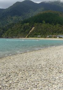
显示 10 / 共 10
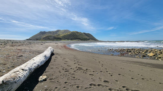
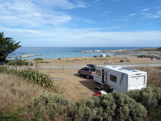
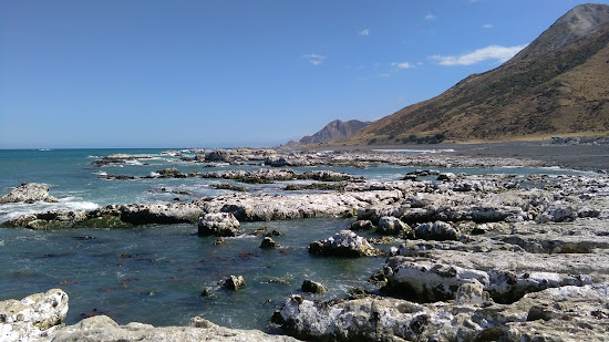
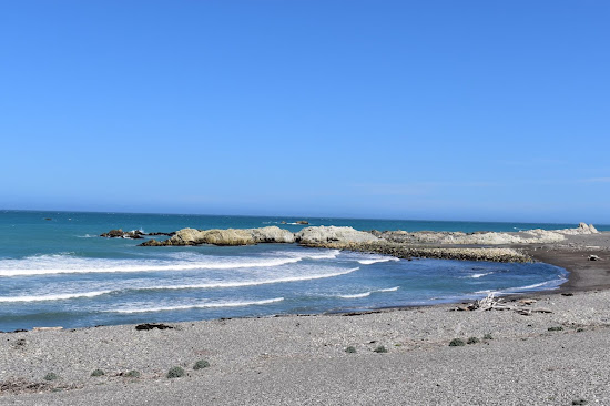
适合放松
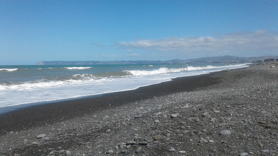
小灰色卵石
适合冲浪
自然海滩(无设施)
浑浊的绿松石色水
适合游泳
沙石海底





适合放松
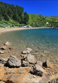
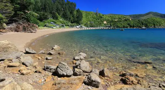
如画
适合皮划艇
清澈的绿松石色水
适合游泳
米色沙子与岩石
沙石海底

Mara Grace
新手海滩游客
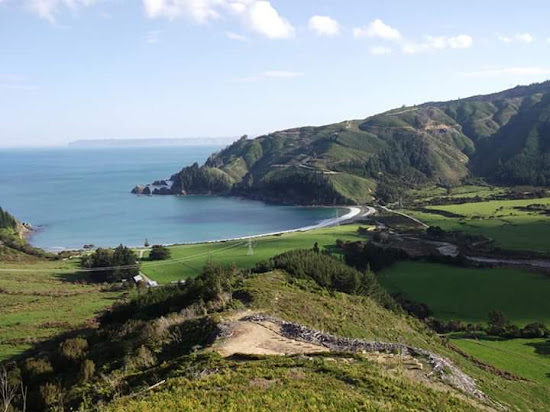
法国峡口是一个我已经去了四分之一世纪的绝对令人惊叹的目的地。这是露营、钓鱼,甚至坐船前往迪乌尔维尔岛的理想地点。这绝对是探索和度过时间的绝佳地方,我强烈推荐。尽管通往峡口的道路可能会非常弯曲,只要小心驾驶就不会有任何问题。别忘了带上你的相机!

Abigail Weaver
新手海滩游客
海滩地区绝对美丽,似乎一些人早晨幸运地看到了海豚群。我强烈建议提前预订,因为可用位置有限,通往那里的道路相当陡峭且是碎石路。尽管旅途具有挑战性,但留在这个令人惊叹的地方绝对是值得的。此外,现场还有一家商店,提供各种便利物品,包括散养鸡蛋。
适合放松
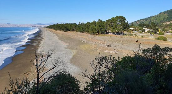
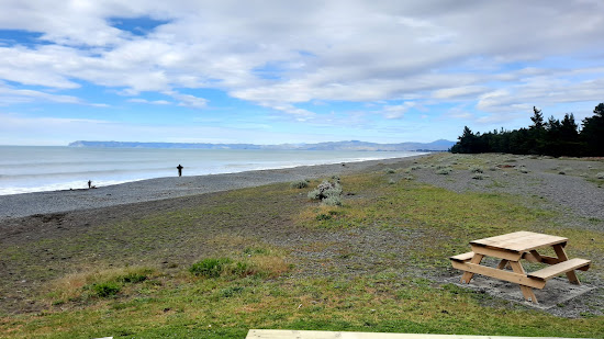
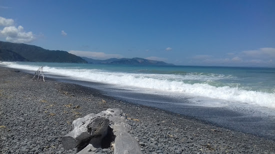
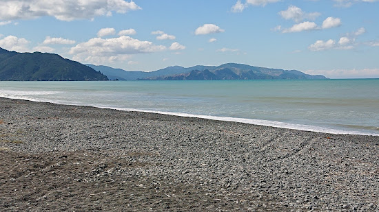
灰卵石
卵石海底
浑浊的绿松石色水
适合游泳
设施齐全的海滩
大潮汐区

一个相当野性的卵石海滩,适合长时间徒步旅行,发现有趣的洞穴和探索地方。游泳时需要小心。沙滩的坡度相当陡峭,海浪有时会很大。在海滩北端有一个称为猴子湾的更有保护性的海湾,可以通过阶梯到达。北端还有一个保护部露营地。
我不知道谷歌先生为什么添加了海滩亭。这不是我帖子的一部分。没有亭子!!

Soren Kade
新手海滩游客
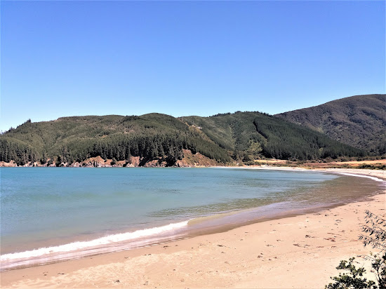
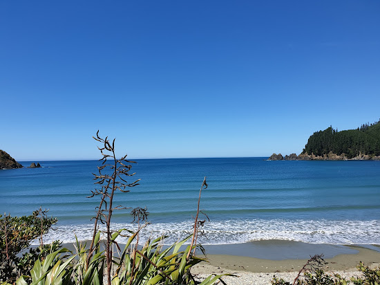
这个海滩是夏季度假的好去处。有指定的野营和搭帐篷区域,尽管海浪可能有点大浪,我看到过人们在里面游泳。海滩非常适合长时间散步,并沿岸设有许多设施。
适合放松
非常适合游泳
自然海滩(无设施)
沙质海底
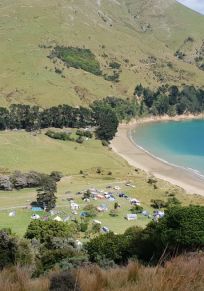
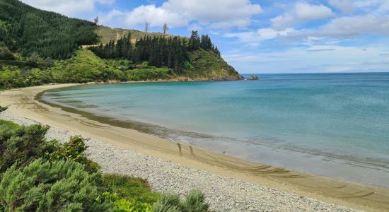
米色沙子
清澈的绿松石色水
大潮汐区

Joey B
新手海滩游客
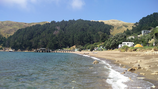
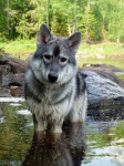
如果沿着安德伍德港路 (Port Underwood Road) 行驶,您会遇到罗宾汉湾 (Robin Hood Bay),这里是与您的狗一起露营的绝佳场所。海滩本身令人惊叹,沙子柔软,非常适合游泳和日光浴。环境保护部在海滩旁设有一个露营地,配有公共厕所。钓鱼也是该地区流行的消遣活动。到达这里后我感到非常平静和满足。由于我们是在圣诞节期间参观的,所以有很多露营车和帐篷。海滩周围环绕着美丽的绿色森林,增添了如画的魅力。如果您正在寻找露营体验,我强烈推荐这个地方。
Nolara Sipp
新手海滩游客
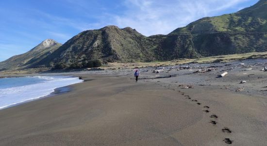
我们在一个阳光明媚的日子参观了海滩,虽然在蜿蜒的碎石路上行驶的路程相当长,但绝对值得。不过,我可能不应该提及这一点,因为现在每个人都想去那里,这可能会破坏魅力。 😊
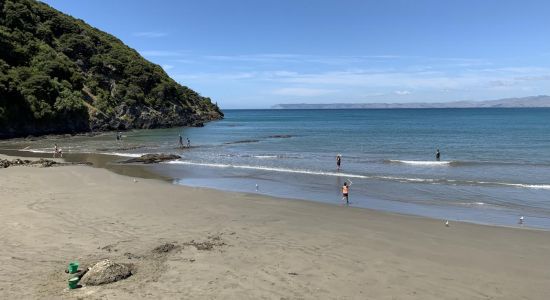
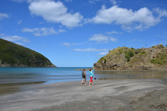
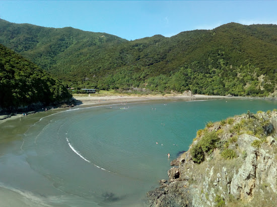


适合放松
非常适合游泳
自然海滩(无设施)
沙质海底
米色沙子
浑浊的绿松石色水
大潮汐区

Mitchell Betz
新手海滩游客
This beach is a must-visit if you're exploring the coast. While it's not ideal for surfing, snorkeling can be enjoyable here. The area also offers plenty of walking trails, although some may find them challenging due to steep terrain.

Evan Kral
新手海滩游客
The beach is really nice and the campsite is great.

适合放松


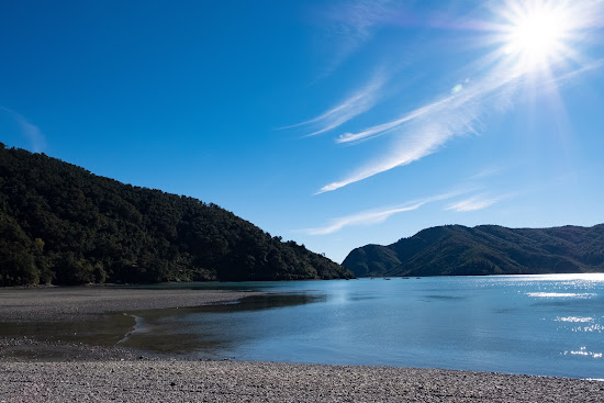
适合放松

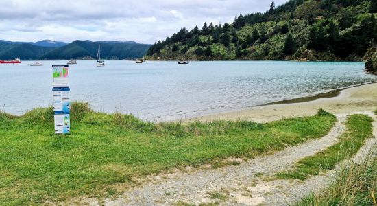
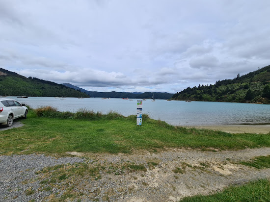
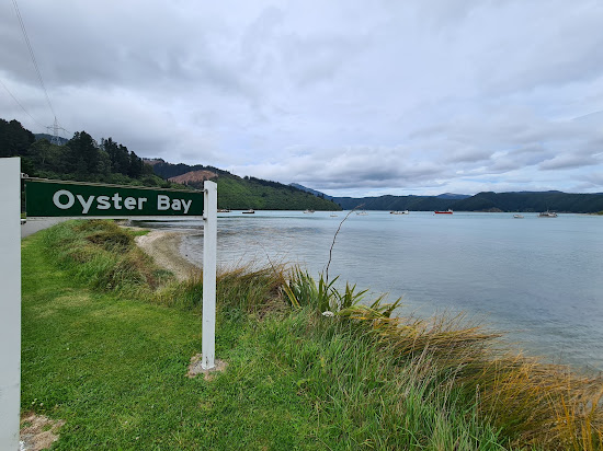
米色沙子与卵石
沙卵石海底
清澈的绿松石色水
设施齐全的海滩
易于访问
步行距离短

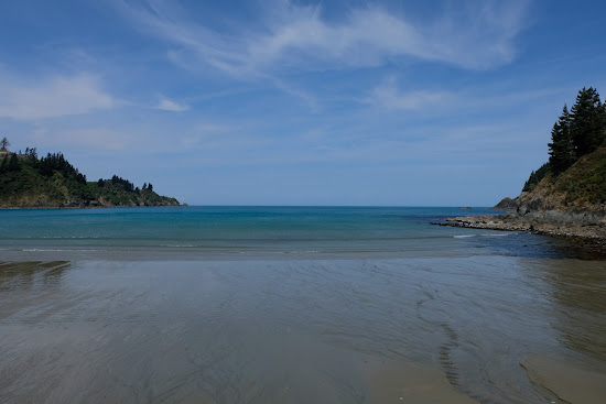
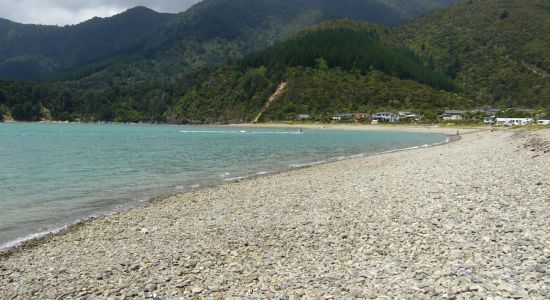
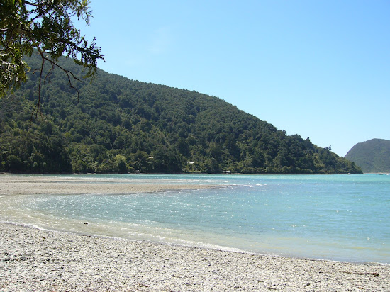
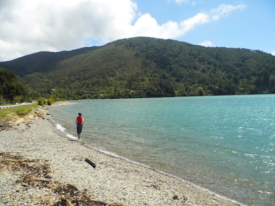
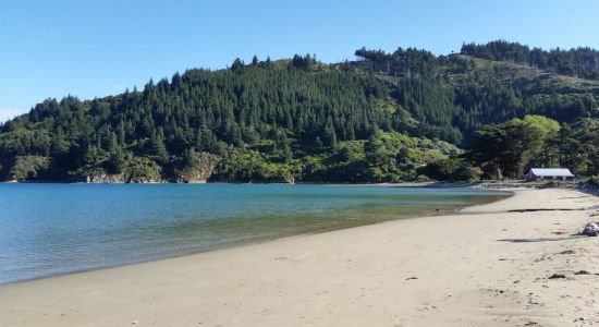
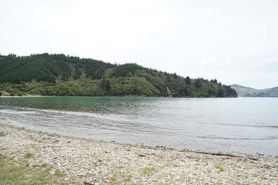
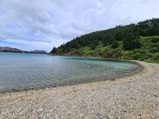
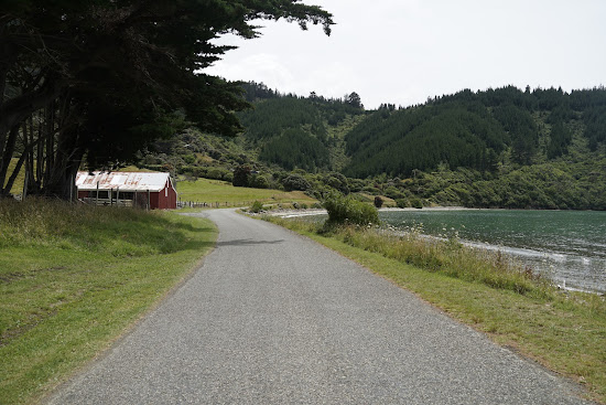
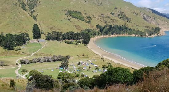
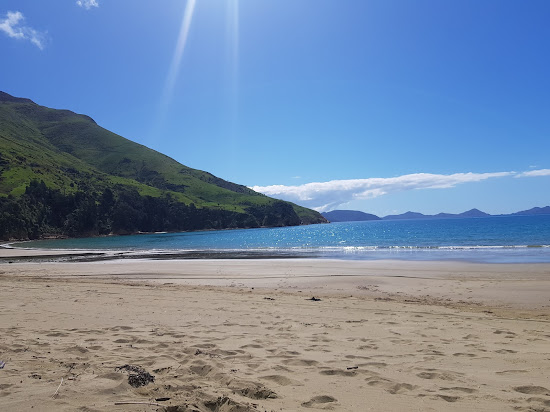
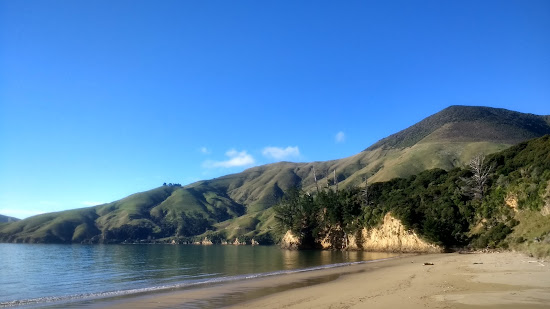
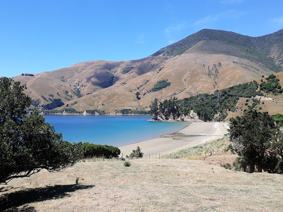
要从皮克顿到达这个海湾,您将体验到世界上最风大的道路之一。这条路一路上上下下。海湾很小,沙子柔软,还有一张长椅。这里是最享受的环境。注意:这条路的封闭部分到此结束,但您可以在石子路面上继续驾驶。


适合放松


适合放松


活跃筛选:
重置全部
最佳海滩
显示 8 / 共 8
适合放松
小灰色卵石
适合冲浪
自然海滩(无设施)
浑浊的绿松石色水
适合游泳
沙石海底
适合放松
如画
适合皮划艇
清澈的绿松石色水
适合游泳
米色沙子与岩石
沙石海底
Mara Grace
新手海滩游客
法国峡口是一个我已经去了四分之一世纪的绝对令人惊叹的目的地。这是露营、钓鱼,甚至坐船前往迪乌尔维尔岛的理想地点。这绝对是探索和度过时间的绝佳地方,我强烈推荐。尽管通往峡口的道路可能会非常弯曲,只要小心驾驶就不会有任何问题。别忘了带上你的相机!
Abigail Weaver
新手海滩游客
海滩地区绝对美丽,似乎一些人早晨幸运地看到了海豚群。我强烈建议提前预订,因为可用位置有限,通往那里的道路相当陡峭且是碎石路。尽管旅途具有挑战性,但留在这个令人惊叹的地方绝对是值得的。此外,现场还有一家商店,提供各种便利物品,包括散养鸡蛋。
适合放松
灰卵石
卵石海底
浑浊的绿松石色水
适合游泳
设施齐全的海滩
大潮汐区
一个相当野性的卵石海滩,适合长时间徒步旅行,发现有趣的洞穴和探索地方。游泳时需要小心。沙滩的坡度相当陡峭,海浪有时会很大。在海滩北端有一个称为猴子湾的更有保护性的海湾,可以通过阶梯到达。北端还有一个保护部露营地。
我不知道谷歌先生为什么添加了海滩亭。这不是我帖子的一部分。没有亭子!!
Soren Kade
新手海滩游客
这个海滩是夏季度假的好去处。有指定的野营和搭帐篷区域,尽管海浪可能有点大浪,我看到过人们在里面游泳。海滩非常适合长时间散步,并沿岸设有许多设施。
适合放松
非常适合游泳
自然海滩(无设施)
沙质海底
米色沙子
清澈的绿松石色水
大潮汐区
Joey B
新手海滩游客
如果沿着安德伍德港路 (Port Underwood Road) 行驶,您会遇到罗宾汉湾 (Robin Hood Bay),这里是与您的狗一起露营的绝佳场所。海滩本身令人惊叹,沙子柔软,非常适合游泳和日光浴。环境保护部在海滩旁设有一个露营地,配有公共厕所。钓鱼也是该地区流行的消遣活动。到达这里后我感到非常平静和满足。由于我们是在圣诞节期间参观的,所以有很多露营车和帐篷。海滩周围环绕着美丽的绿色森林,增添了如画的魅力。如果您正在寻找露营体验,我强烈推荐这个地方。
Nolara Sipp
新手海滩游客
我们在一个阳光明媚的日子参观了海滩,虽然在蜿蜒的碎石路上行驶的路程相当长,但绝对值得。不过,我可能不应该提及这一点,因为现在每个人都想去那里,这可能会破坏魅力。 😊
适合放松
非常适合游泳
自然海滩(无设施)
沙质海底
米色沙子
浑浊的绿松石色水
大潮汐区
Mitchell Betz
新手海滩游客
This beach is a must-visit if you're exploring the coast. While it's not ideal for surfing, snorkeling can be enjoyable here. The area also offers plenty of walking trails, although some may find them challenging due to steep terrain.
Evan Kral
新手海滩游客
The beach is really nice and the campsite is great.
适合放松
适合放松
适合放松
活跃筛选:
重置全部
高度清洁
显示 6 / 共 7
适合放松
小灰色卵石
适合冲浪
自然海滩(无设施)
浑浊的绿松石色水
适合游泳
沙石海底
适合放松
灰卵石
卵石海底
浑浊的绿松石色水
适合游泳
设施齐全的海滩
大潮汐区
一个相当野性的卵石海滩,适合长时间徒步旅行,发现有趣的洞穴和探索地方。游泳时需要小心。沙滩的坡度相当陡峭,海浪有时会很大。在海滩北端有一个称为猴子湾的更有保护性的海湾,可以通过阶梯到达。北端还有一个保护部露营地。
我不知道谷歌先生为什么添加了海滩亭。这不是我帖子的一部分。没有亭子!!
Soren Kade
新手海滩游客
这个海滩是夏季度假的好去处。有指定的野营和搭帐篷区域,尽管海浪可能有点大浪,我看到过人们在里面游泳。海滩非常适合长时间散步,并沿岸设有许多设施。
适合放松
非常适合游泳
自然海滩(无设施)
沙质海底
米色沙子
清澈的绿松石色水
大潮汐区
Joey B
新手海滩游客
如果沿着安德伍德港路 (Port Underwood Road) 行驶,您会遇到罗宾汉湾 (Robin Hood Bay),这里是与您的狗一起露营的绝佳场所。海滩本身令人惊叹,沙子柔软,非常适合游泳和日光浴。环境保护部在海滩旁设有一个露营地,配有公共厕所。钓鱼也是该地区流行的消遣活动。到达这里后我感到非常平静和满足。由于我们是在圣诞节期间参观的,所以有很多露营车和帐篷。海滩周围环绕着美丽的绿色森林,增添了如画的魅力。如果您正在寻找露营体验,我强烈推荐这个地方。
Nolara Sipp
新手海滩游客
我们在一个阳光明媚的日子参观了海滩,虽然在蜿蜒的碎石路上行驶的路程相当长,但绝对值得。不过,我可能不应该提及这一点,因为现在每个人都想去那里,这可能会破坏魅力。 😊
适合放松
适合放松
适合放松
活跃筛选:
重置全部
有停车位
显示 6 / 共 10
适合放松
如画
适合皮划艇
清澈的绿松石色水
适合游泳
米色沙子与岩石
沙石海底
Mara Grace
新手海滩游客
法国峡口是一个我已经去了四分之一世纪的绝对令人惊叹的目的地。这是露营、钓鱼,甚至坐船前往迪乌尔维尔岛的理想地点。这绝对是探索和度过时间的绝佳地方,我强烈推荐。尽管通往峡口的道路可能会非常弯曲,只要小心驾驶就不会有任何问题。别忘了带上你的相机!
Abigail Weaver
新手海滩游客
海滩地区绝对美丽,似乎一些人早晨幸运地看到了海豚群。我强烈建议提前预订,因为可用位置有限,通往那里的道路相当陡峭且是碎石路。尽管旅途具有挑战性,但留在这个令人惊叹的地方绝对是值得的。此外,现场还有一家商店,提供各种便利物品,包括散养鸡蛋。
适合放松
小灰色卵石
适合冲浪
自然海滩(无设施)
浑浊的绿松石色水
适合游泳
沙石海底
适合放松
灰卵石
卵石海底
浑浊的绿松石色水
适合游泳
设施齐全的海滩
大潮汐区
一个相当野性的卵石海滩,适合长时间徒步旅行,发现有趣的洞穴和探索地方。游泳时需要小心。沙滩的坡度相当陡峭,海浪有时会很大。在海滩北端有一个称为猴子湾的更有保护性的海湾,可以通过阶梯到达。北端还有一个保护部露营地。
我不知道谷歌先生为什么添加了海滩亭。这不是我帖子的一部分。没有亭子!!
Soren Kade
新手海滩游客
这个海滩是夏季度假的好去处。有指定的野营和搭帐篷区域,尽管海浪可能有点大浪,我看到过人们在里面游泳。海滩非常适合长时间散步,并沿岸设有许多设施。
适合放松
非常适合游泳
自然海滩(无设施)
沙质海底
米色沙子
清澈的绿松石色水
大潮汐区
Joey B
新手海滩游客
如果沿着安德伍德港路 (Port Underwood Road) 行驶,您会遇到罗宾汉湾 (Robin Hood Bay),这里是与您的狗一起露营的绝佳场所。海滩本身令人惊叹,沙子柔软,非常适合游泳和日光浴。环境保护部在海滩旁设有一个露营地,配有公共厕所。钓鱼也是该地区流行的消遣活动。到达这里后我感到非常平静和满足。由于我们是在圣诞节期间参观的,所以有很多露营车和帐篷。海滩周围环绕着美丽的绿色森林,增添了如画的魅力。如果您正在寻找露营体验,我强烈推荐这个地方。
Nolara Sipp
新手海滩游客
我们在一个阳光明媚的日子参观了海滩,虽然在蜿蜒的碎石路上行驶的路程相当长,但绝对值得。不过,我可能不应该提及这一点,因为现在每个人都想去那里,这可能会破坏魅力。 😊
适合放松
非常适合游泳
自然海滩(无设施)
沙质海底
米色沙子
浑浊的绿松石色水
大潮汐区
Mitchell Betz
新手海滩游客
This beach is a must-visit if you're exploring the coast. While it's not ideal for surfing, snorkeling can be enjoyable here. The area also offers plenty of walking trails, although some may find them challenging due to steep terrain.
Evan Kral
新手海滩游客
The beach is really nice and the campsite is great.
活跃筛选:
重置全部
放松海滩
显示 6 / 共 9
适合放松
如画
适合皮划艇
清澈的绿松石色水
适合游泳
米色沙子与岩石
沙石海底
Mara Grace
新手海滩游客
法国峡口是一个我已经去了四分之一世纪的绝对令人惊叹的目的地。这是露营、钓鱼,甚至坐船前往迪乌尔维尔岛的理想地点。这绝对是探索和度过时间的绝佳地方,我强烈推荐。尽管通往峡口的道路可能会非常弯曲,只要小心驾驶就不会有任何问题。别忘了带上你的相机!
Abigail Weaver
新手海滩游客
海滩地区绝对美丽,似乎一些人早晨幸运地看到了海豚群。我强烈建议提前预订,因为可用位置有限,通往那里的道路相当陡峭且是碎石路。尽管旅途具有挑战性,但留在这个令人惊叹的地方绝对是值得的。此外,现场还有一家商店,提供各种便利物品,包括散养鸡蛋。
适合放松
小灰色卵石
适合冲浪
自然海滩(无设施)
浑浊的绿松石色水
适合游泳
沙石海底
适合放松
灰卵石
卵石海底
浑浊的绿松石色水
适合游泳
设施齐全的海滩
大潮汐区
一个相当野性的卵石海滩,适合长时间徒步旅行,发现有趣的洞穴和探索地方。游泳时需要小心。沙滩的坡度相当陡峭,海浪有时会很大。在海滩北端有一个称为猴子湾的更有保护性的海湾,可以通过阶梯到达。北端还有一个保护部露营地。
我不知道谷歌先生为什么添加了海滩亭。这不是我帖子的一部分。没有亭子!!
Soren Kade
新手海滩游客
这个海滩是夏季度假的好去处。有指定的野营和搭帐篷区域,尽管海浪可能有点大浪,我看到过人们在里面游泳。海滩非常适合长时间散步,并沿岸设有许多设施。
适合放松
非常适合游泳
自然海滩(无设施)
沙质海底
米色沙子
清澈的绿松石色水
大潮汐区
Joey B
新手海滩游客
如果沿着安德伍德港路 (Port Underwood Road) 行驶,您会遇到罗宾汉湾 (Robin Hood Bay),这里是与您的狗一起露营的绝佳场所。海滩本身令人惊叹,沙子柔软,非常适合游泳和日光浴。环境保护部在海滩旁设有一个露营地,配有公共厕所。钓鱼也是该地区流行的消遣活动。到达这里后我感到非常平静和满足。由于我们是在圣诞节期间参观的,所以有很多露营车和帐篷。海滩周围环绕着美丽的绿色森林,增添了如画的魅力。如果您正在寻找露营体验,我强烈推荐这个地方。
Nolara Sipp
新手海滩游客
我们在一个阳光明媚的日子参观了海滩,虽然在蜿蜒的碎石路上行驶的路程相当长,但绝对值得。不过,我可能不应该提及这一点,因为现在每个人都想去那里,这可能会破坏魅力。 😊
适合放松
非常适合游泳
自然海滩(无设施)
沙质海底
米色沙子
浑浊的绿松石色水
大潮汐区
Mitchell Betz
新手海滩游客
This beach is a must-visit if you're exploring the coast. While it's not ideal for surfing, snorkeling can be enjoyable here. The area also offers plenty of walking trails, although some may find them challenging due to steep terrain.
Evan Kral
新手海滩游客
The beach is really nice and the campsite is great.