Seddon: 最近的海滩 - 41 公里 范围内 8
乡村, 马尔堡大区, 新西兰
主要功能: 野生海滩, 适合皮划艇, 适合冲浪
在地图上查看 8 个海滩
地图模式包含更多海滩、周边酒店价格,以及海滩类型、沙滩材质、拥挤程度和配套设施等筛选条件。
打开地图
搜索半径
更改半径
范围内的所有海滩 41 公里 从 中心
显示 8 / 共 8
在41公里内
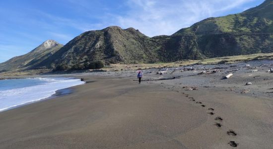
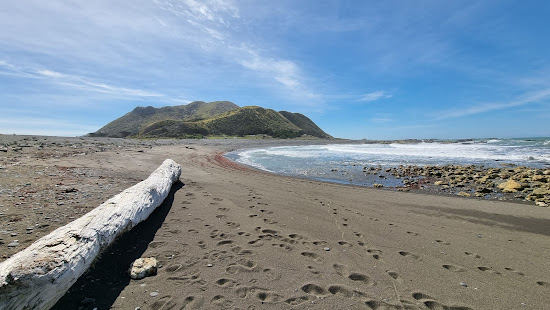
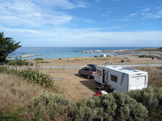
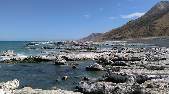
适合放松
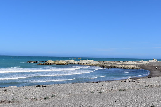
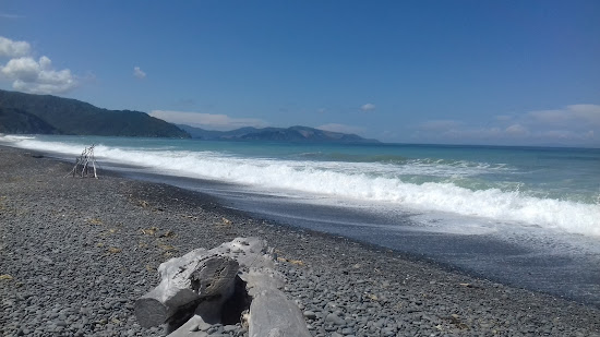
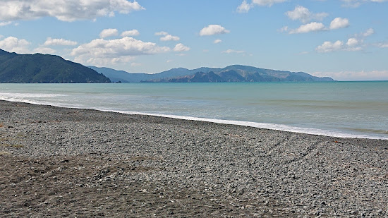
Ward Beach
21.5 公里 距中心 Seddon
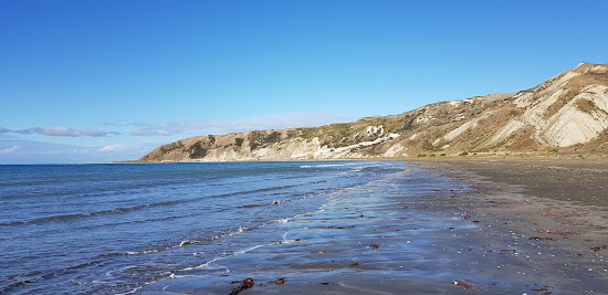
小灰色卵石
适合冲浪
自然海滩(无设施)
浑浊的绿松石色水
适合游泳
沙石海底

我们经常来这里,因为我们住在40分钟车程的地方。全家人都喜欢这里,这对我们来说是一个很棒的出游日。带上野餐吧!在这个时候(夏天)这个地区 - 以及新西兰的很大一部分 - 通常是禁止生火的,我不确定是否可以使用烧烤架。在沃德的主路上有一家可爱的咖啡馆,提供厕所、加油站和一个大型停车场。

在前往那里的路上要小心。有一个“牛槽”,但没有告诉你跨越它的最佳速度。我建议以最低的速度通过,因为它比减速带要糟糕得多。同时在路上遇到了一只带着两个小羊的母羊,它们很难跑开,所以要对随机动物格外小心。海滩非常崎岖,而且可能会有风,但总体来说很美丽。
适合放松
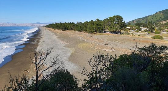
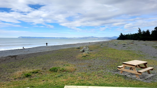
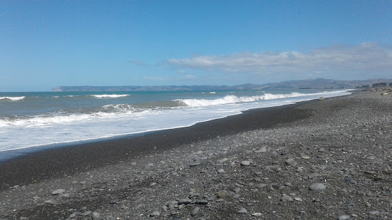
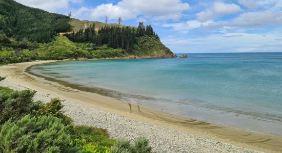
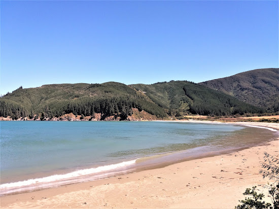
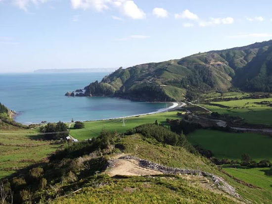
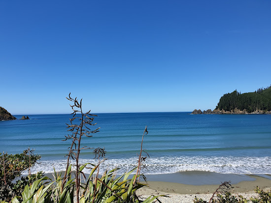
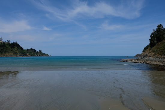
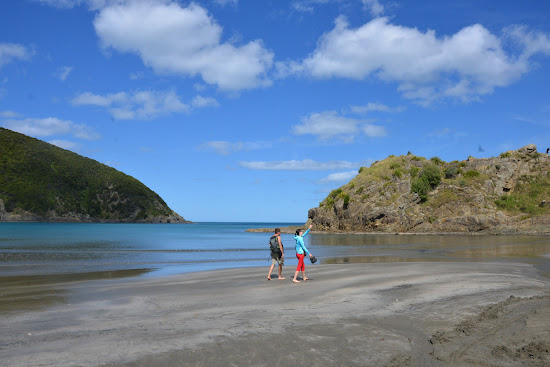
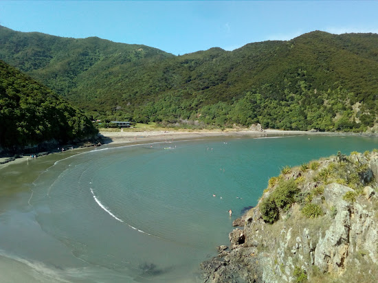
Rarangi Beach
28.2 公里 距中心 Seddon

适合放松




适合放松
Whites Bay
31.7 公里 距中心 Seddon
非常适合游泳
自然海滩(无设施)
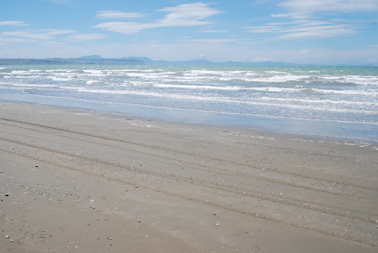
沙质海底
米色沙子
浑浊的绿松石色水
大潮汐区

非常 sheltered 的沙滩,有很多停车位,即使在圣诞节我们也能找到一个地方。通往这里的路相对狭窄,但在转弯时要小心,一切都很好。
附近有良好的厕所设施,似乎这里还有相当多的步道,不过我还没有去探险。
Soren Kade
新手海滩游客
This beach is perfect for family gatherings or picnics with a large group. The restroom and bathing facilities are well-maintained, and camping is also an option at Whites Bay. Just keep in mind that the beach is open to the public. We hiked from Monkey's Bay, which took us about 45 minutes. There are two cliffs to climb, one on the left and one on the right. The right cliff offers a stunning view of the sea. Don't forget to bring a sun shelter for some shade.

适合放松
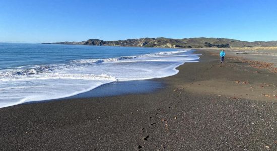
Marfell's Beach
12.3 公里 距中心 Seddon
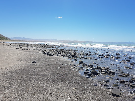
小棕色卵石
浑浊的绿松石色水
适合游泳
需要水袜
沙石海底
大潮汐区

Einar Schmidt
新手海滩游客
On November 14, 2016, a magnitude 7.8 earthquake struck the east coast of New Zealand's South Island. With a depth of just 15km, the quake was felt across the country and was the second most powerful in New Zealand's history, surpassed only by the magnitude 8.2 earthquake that hit Wairarapa in 1855. The quake generated a tsunami with waves up to 10 meters high in Cook Strait, and a newly exposed strip of shoreline between Wellington and the Hutt Valley provided a safe road and railway route, making previously impassable coastal roads accessible at high tide.
A similar phenomenon occurred at Marfell's Beach scenic walk to the lighthouse, a popular 6km trail that takes about 90 minutes to complete. The Marfells Beach-Cape Campbell walk is an unmarked route that follows the beach from the Marfells Beach camping ground to Cape Campbell, the southernmost tip of Cook Strait.
Before the November 2016 Kaikoura earthquake, access to Cape Campbell required careful timing with low tide. However, the earthquake caused significant uplift, making the beach walk more accessible and less dependent on the tides. It is still wise to check weather conditions before setting out.
The turnoff to Marfells Beach is about 36 kilometers south of Blenheim, with the beach located a further 8km along a mostly sealed road.
Cook Strait is known as one of the world's roughest stretches of water, part of the westerly wind belt called the Roaring Forties. This has led to numerous shipwrecks in the 19th century. The average ocean depth of Cook Strait is about 128 meters.
Between 1845 and 1947, 19 ships met their fate along this east coast stretch. The earthquake uplift has revealed numerous rocks and reefs, explaining the perilous conditions.
The lighthouse is located at the southernmost extreme of Cook Strait. Marfells Beach features a DOC camping ground, which is quite popular. This area is one of the sunniest places in New Zealand, so visitors can expect excellent weather.
Nearby, as you drive into Marfell's Beach, you'll see the local salt factory. Taking advantage of Marlborough’s low rainfall, the Dominion Salt company has been producing salt here since 1942, generating over 70,000 tonnes of sea salt annually.
While there are no public tours or sales at the saltworks, you can view the evaporation ponds and
Sara Linn
新手海滩游客
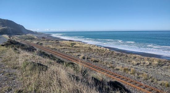
位置优越,直接坐落于沙滩上,四轮摩托车可达,波浪温和。您可以在一个方向上步行到老码头,在另一个方向上前往岬角。设施干净,还有树荫处。

适合放松
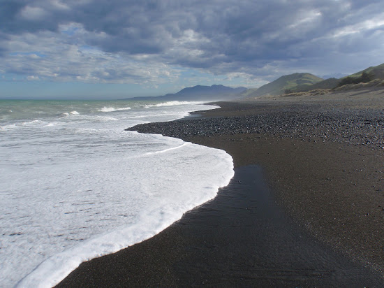
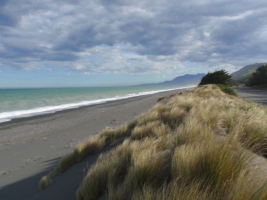
Black sand Beach
33.7 公里 距中心 Seddon

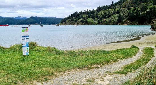
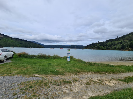
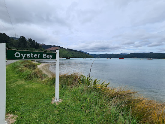
Oyster Bay Beach
41.2 公里 距中心 Seddon
米色沙子与卵石
沙卵石海底
清澈的绿松石色水
设施齐全的海滩
易于访问
步行距离短


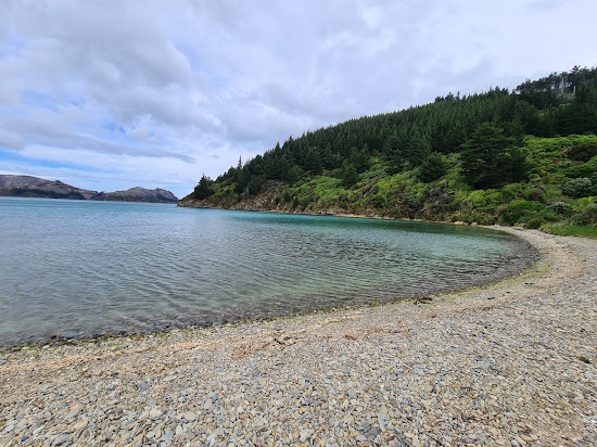
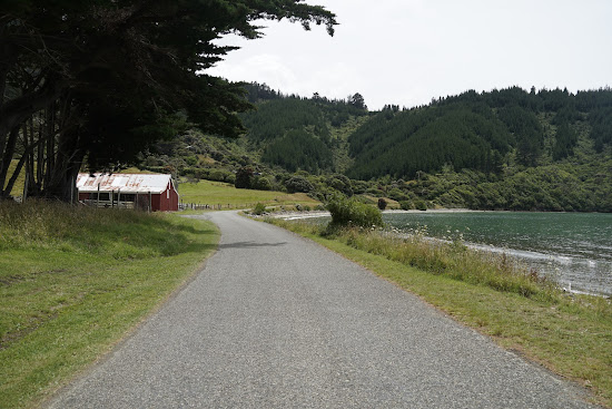
要从皮克顿到达这个海湾,您将体验到世界上最风大的道路之一。这条路一路上上下下。海湾很小,沙子柔软,还有一张长椅。这里是最享受的环境。注意:这条路的封闭部分到此结束,但您可以在石子路面上继续驾驶。

适合放松
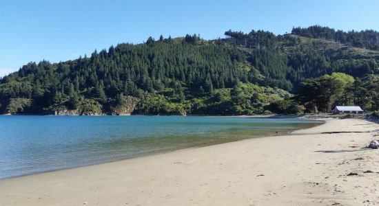
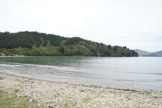
Ocean Bay Beach
37.9 公里 距中心 Seddon

活跃筛选:
重置全部
最佳海滩
显示 6 / 共 6
在41公里内
适合放松
Ward Beach
21.5 公里 距中心 Seddon
小灰色卵石
适合冲浪
自然海滩(无设施)
浑浊的绿松石色水
适合游泳
沙石海底
我们经常来这里,因为我们住在40分钟车程的地方。全家人都喜欢这里,这对我们来说是一个很棒的出游日。带上野餐吧!在这个时候(夏天)这个地区 - 以及新西兰的很大一部分 - 通常是禁止生火的,我不确定是否可以使用烧烤架。在沃德的主路上有一家可爱的咖啡馆,提供厕所、加油站和一个大型停车场。
在前往那里的路上要小心。有一个“牛槽”,但没有告诉你跨越它的最佳速度。我建议以最低的速度通过,因为它比减速带要糟糕得多。同时在路上遇到了一只带着两个小羊的母羊,它们很难跑开,所以要对随机动物格外小心。海滩非常崎岖,而且可能会有风,但总体来说很美丽。
适合放松
Rarangi Beach
28.2 公里 距中心 Seddon
适合放松
适合放松
Whites Bay
31.7 公里 距中心 Seddon
非常适合游泳
自然海滩(无设施)
沙质海底
米色沙子
浑浊的绿松石色水
大潮汐区
非常 sheltered 的沙滩,有很多停车位,即使在圣诞节我们也能找到一个地方。通往这里的路相对狭窄,但在转弯时要小心,一切都很好。
附近有良好的厕所设施,似乎这里还有相当多的步道,不过我还没有去探险。
Soren Kade
新手海滩游客
This beach is perfect for family gatherings or picnics with a large group. The restroom and bathing facilities are well-maintained, and camping is also an option at Whites Bay. Just keep in mind that the beach is open to the public. We hiked from Monkey's Bay, which took us about 45 minutes. There are two cliffs to climb, one on the left and one on the right. The right cliff offers a stunning view of the sea. Don't forget to bring a sun shelter for some shade.
适合放松
Marfell's Beach
12.3 公里 距中心 Seddon
小棕色卵石
浑浊的绿松石色水
适合游泳
需要水袜
沙石海底
大潮汐区
Einar Schmidt
新手海滩游客
On November 14, 2016, a magnitude 7.8 earthquake struck the east coast of New Zealand's South Island. With a depth of just 15km, the quake was felt across the country and was the second most powerful in New Zealand's history, surpassed only by the magnitude 8.2 earthquake that hit Wairarapa in 1855. The quake generated a tsunami with waves up to 10 meters high in Cook Strait, and a newly exposed strip of shoreline between Wellington and the Hutt Valley provided a safe road and railway route, making previously impassable coastal roads accessible at high tide.
A similar phenomenon occurred at Marfell's Beach scenic walk to the lighthouse, a popular 6km trail that takes about 90 minutes to complete. The Marfells Beach-Cape Campbell walk is an unmarked route that follows the beach from the Marfells Beach camping ground to Cape Campbell, the southernmost tip of Cook Strait.
Before the November 2016 Kaikoura earthquake, access to Cape Campbell required careful timing with low tide. However, the earthquake caused significant uplift, making the beach walk more accessible and less dependent on the tides. It is still wise to check weather conditions before setting out.
The turnoff to Marfells Beach is about 36 kilometers south of Blenheim, with the beach located a further 8km along a mostly sealed road.
Cook Strait is known as one of the world's roughest stretches of water, part of the westerly wind belt called the Roaring Forties. This has led to numerous shipwrecks in the 19th century. The average ocean depth of Cook Strait is about 128 meters.
Between 1845 and 1947, 19 ships met their fate along this east coast stretch. The earthquake uplift has revealed numerous rocks and reefs, explaining the perilous conditions.
The lighthouse is located at the southernmost extreme of Cook Strait. Marfells Beach features a DOC camping ground, which is quite popular. This area is one of the sunniest places in New Zealand, so visitors can expect excellent weather.
Nearby, as you drive into Marfell's Beach, you'll see the local salt factory. Taking advantage of Marlborough’s low rainfall, the Dominion Salt company has been producing salt here since 1942, generating over 70,000 tonnes of sea salt annually.
While there are no public tours or sales at the saltworks, you can view the evaporation ponds and
Sara Linn
新手海滩游客
位置优越,直接坐落于沙滩上,四轮摩托车可达,波浪温和。您可以在一个方向上步行到老码头,在另一个方向上前往岬角。设施干净,还有树荫处。
适合放松
Black sand Beach
33.7 公里 距中心 Seddon
活跃筛选:
重置全部
自然海滩
显示 6 / 共 6
在41公里内
适合放松
Marfell's Beach
12.3 公里 距中心 Seddon
小棕色卵石
浑浊的绿松石色水
适合游泳
需要水袜
沙石海底
大潮汐区
Einar Schmidt
新手海滩游客
On November 14, 2016, a magnitude 7.8 earthquake struck the east coast of New Zealand's South Island. With a depth of just 15km, the quake was felt across the country and was the second most powerful in New Zealand's history, surpassed only by the magnitude 8.2 earthquake that hit Wairarapa in 1855. The quake generated a tsunami with waves up to 10 meters high in Cook Strait, and a newly exposed strip of shoreline between Wellington and the Hutt Valley provided a safe road and railway route, making previously impassable coastal roads accessible at high tide.
A similar phenomenon occurred at Marfell's Beach scenic walk to the lighthouse, a popular 6km trail that takes about 90 minutes to complete. The Marfells Beach-Cape Campbell walk is an unmarked route that follows the beach from the Marfells Beach camping ground to Cape Campbell, the southernmost tip of Cook Strait.
Before the November 2016 Kaikoura earthquake, access to Cape Campbell required careful timing with low tide. However, the earthquake caused significant uplift, making the beach walk more accessible and less dependent on the tides. It is still wise to check weather conditions before setting out.
The turnoff to Marfells Beach is about 36 kilometers south of Blenheim, with the beach located a further 8km along a mostly sealed road.
Cook Strait is known as one of the world's roughest stretches of water, part of the westerly wind belt called the Roaring Forties. This has led to numerous shipwrecks in the 19th century. The average ocean depth of Cook Strait is about 128 meters.
Between 1845 and 1947, 19 ships met their fate along this east coast stretch. The earthquake uplift has revealed numerous rocks and reefs, explaining the perilous conditions.
The lighthouse is located at the southernmost extreme of Cook Strait. Marfells Beach features a DOC camping ground, which is quite popular. This area is one of the sunniest places in New Zealand, so visitors can expect excellent weather.
Nearby, as you drive into Marfell's Beach, you'll see the local salt factory. Taking advantage of Marlborough’s low rainfall, the Dominion Salt company has been producing salt here since 1942, generating over 70,000 tonnes of sea salt annually.
While there are no public tours or sales at the saltworks, you can view the evaporation ponds and
Sara Linn
新手海滩游客
位置优越,直接坐落于沙滩上,四轮摩托车可达,波浪温和。您可以在一个方向上步行到老码头,在另一个方向上前往岬角。设施干净,还有树荫处。
适合放松
Ward Beach
21.5 公里 距中心 Seddon
小灰色卵石
适合冲浪
自然海滩(无设施)
浑浊的绿松石色水
适合游泳
沙石海底
我们经常来这里,因为我们住在40分钟车程的地方。全家人都喜欢这里,这对我们来说是一个很棒的出游日。带上野餐吧!在这个时候(夏天)这个地区 - 以及新西兰的很大一部分 - 通常是禁止生火的,我不确定是否可以使用烧烤架。在沃德的主路上有一家可爱的咖啡馆,提供厕所、加油站和一个大型停车场。
在前往那里的路上要小心。有一个“牛槽”,但没有告诉你跨越它的最佳速度。我建议以最低的速度通过,因为它比减速带要糟糕得多。同时在路上遇到了一只带着两个小羊的母羊,它们很难跑开,所以要对随机动物格外小心。海滩非常崎岖,而且可能会有风,但总体来说很美丽。
适合放松
Whites Bay
31.7 公里 距中心 Seddon
非常适合游泳
自然海滩(无设施)
沙质海底
米色沙子
浑浊的绿松石色水
大潮汐区
非常 sheltered 的沙滩,有很多停车位,即使在圣诞节我们也能找到一个地方。通往这里的路相对狭窄,但在转弯时要小心,一切都很好。
附近有良好的厕所设施,似乎这里还有相当多的步道,不过我还没有去探险。
Soren Kade
新手海滩游客
This beach is perfect for family gatherings or picnics with a large group. The restroom and bathing facilities are well-maintained, and camping is also an option at Whites Bay. Just keep in mind that the beach is open to the public. We hiked from Monkey's Bay, which took us about 45 minutes. There are two cliffs to climb, one on the left and one on the right. The right cliff offers a stunning view of the sea. Don't forget to bring a sun shelter for some shade.
适合放松
Black sand Beach
33.7 公里 距中心 Seddon
适合放松
Oyster Bay Beach
41.2 公里 距中心 Seddon
米色沙子与卵石
沙卵石海底
清澈的绿松石色水
设施齐全的海滩
易于访问
步行距离短
要从皮克顿到达这个海湾,您将体验到世界上最风大的道路之一。这条路一路上上下下。海湾很小,沙子柔软,还有一张长椅。这里是最享受的环境。注意:这条路的封闭部分到此结束,但您可以在石子路面上继续驾驶。
活跃筛选:
重置全部
有停车位
显示 6 / 共 7
在41公里内
适合放松
Marfell's Beach
12.3 公里 距中心 Seddon
小棕色卵石
浑浊的绿松石色水
适合游泳
需要水袜
沙石海底
大潮汐区
Einar Schmidt
新手海滩游客
On November 14, 2016, a magnitude 7.8 earthquake struck the east coast of New Zealand's South Island. With a depth of just 15km, the quake was felt across the country and was the second most powerful in New Zealand's history, surpassed only by the magnitude 8.2 earthquake that hit Wairarapa in 1855. The quake generated a tsunami with waves up to 10 meters high in Cook Strait, and a newly exposed strip of shoreline between Wellington and the Hutt Valley provided a safe road and railway route, making previously impassable coastal roads accessible at high tide.
A similar phenomenon occurred at Marfell's Beach scenic walk to the lighthouse, a popular 6km trail that takes about 90 minutes to complete. The Marfells Beach-Cape Campbell walk is an unmarked route that follows the beach from the Marfells Beach camping ground to Cape Campbell, the southernmost tip of Cook Strait.
Before the November 2016 Kaikoura earthquake, access to Cape Campbell required careful timing with low tide. However, the earthquake caused significant uplift, making the beach walk more accessible and less dependent on the tides. It is still wise to check weather conditions before setting out.
The turnoff to Marfells Beach is about 36 kilometers south of Blenheim, with the beach located a further 8km along a mostly sealed road.
Cook Strait is known as one of the world's roughest stretches of water, part of the westerly wind belt called the Roaring Forties. This has led to numerous shipwrecks in the 19th century. The average ocean depth of Cook Strait is about 128 meters.
Between 1845 and 1947, 19 ships met their fate along this east coast stretch. The earthquake uplift has revealed numerous rocks and reefs, explaining the perilous conditions.
The lighthouse is located at the southernmost extreme of Cook Strait. Marfells Beach features a DOC camping ground, which is quite popular. This area is one of the sunniest places in New Zealand, so visitors can expect excellent weather.
Nearby, as you drive into Marfell's Beach, you'll see the local salt factory. Taking advantage of Marlborough’s low rainfall, the Dominion Salt company has been producing salt here since 1942, generating over 70,000 tonnes of sea salt annually.
While there are no public tours or sales at the saltworks, you can view the evaporation ponds and
Sara Linn
新手海滩游客
位置优越,直接坐落于沙滩上,四轮摩托车可达,波浪温和。您可以在一个方向上步行到老码头,在另一个方向上前往岬角。设施干净,还有树荫处。
适合放松
Ward Beach
21.5 公里 距中心 Seddon
小灰色卵石
适合冲浪
自然海滩(无设施)
浑浊的绿松石色水
适合游泳
沙石海底
我们经常来这里,因为我们住在40分钟车程的地方。全家人都喜欢这里,这对我们来说是一个很棒的出游日。带上野餐吧!在这个时候(夏天)这个地区 - 以及新西兰的很大一部分 - 通常是禁止生火的,我不确定是否可以使用烧烤架。在沃德的主路上有一家可爱的咖啡馆,提供厕所、加油站和一个大型停车场。
在前往那里的路上要小心。有一个“牛槽”,但没有告诉你跨越它的最佳速度。我建议以最低的速度通过,因为它比减速带要糟糕得多。同时在路上遇到了一只带着两个小羊的母羊,它们很难跑开,所以要对随机动物格外小心。海滩非常崎岖,而且可能会有风,但总体来说很美丽。
适合放松
Rarangi Beach
28.2 公里 距中心 Seddon
适合放松
Whites Bay
31.7 公里 距中心 Seddon
非常适合游泳
自然海滩(无设施)
沙质海底
米色沙子
浑浊的绿松石色水
大潮汐区
非常 sheltered 的沙滩,有很多停车位,即使在圣诞节我们也能找到一个地方。通往这里的路相对狭窄,但在转弯时要小心,一切都很好。
附近有良好的厕所设施,似乎这里还有相当多的步道,不过我还没有去探险。
Soren Kade
新手海滩游客
This beach is perfect for family gatherings or picnics with a large group. The restroom and bathing facilities are well-maintained, and camping is also an option at Whites Bay. Just keep in mind that the beach is open to the public. We hiked from Monkey's Bay, which took us about 45 minutes. There are two cliffs to climb, one on the left and one on the right. The right cliff offers a stunning view of the sea. Don't forget to bring a sun shelter for some shade.
适合放松
适合放松
Ocean Bay Beach
37.9 公里 距中心 Seddon
活跃筛选:
重置全部
放松海滩
显示 6 / 共 7
在41公里内
适合放松
Marfell's Beach
12.3 公里 距中心 Seddon
小棕色卵石
浑浊的绿松石色水
适合游泳
需要水袜
沙石海底
大潮汐区
Einar Schmidt
新手海滩游客
On November 14, 2016, a magnitude 7.8 earthquake struck the east coast of New Zealand's South Island. With a depth of just 15km, the quake was felt across the country and was the second most powerful in New Zealand's history, surpassed only by the magnitude 8.2 earthquake that hit Wairarapa in 1855. The quake generated a tsunami with waves up to 10 meters high in Cook Strait, and a newly exposed strip of shoreline between Wellington and the Hutt Valley provided a safe road and railway route, making previously impassable coastal roads accessible at high tide.
A similar phenomenon occurred at Marfell's Beach scenic walk to the lighthouse, a popular 6km trail that takes about 90 minutes to complete. The Marfells Beach-Cape Campbell walk is an unmarked route that follows the beach from the Marfells Beach camping ground to Cape Campbell, the southernmost tip of Cook Strait.
Before the November 2016 Kaikoura earthquake, access to Cape Campbell required careful timing with low tide. However, the earthquake caused significant uplift, making the beach walk more accessible and less dependent on the tides. It is still wise to check weather conditions before setting out.
The turnoff to Marfells Beach is about 36 kilometers south of Blenheim, with the beach located a further 8km along a mostly sealed road.
Cook Strait is known as one of the world's roughest stretches of water, part of the westerly wind belt called the Roaring Forties. This has led to numerous shipwrecks in the 19th century. The average ocean depth of Cook Strait is about 128 meters.
Between 1845 and 1947, 19 ships met their fate along this east coast stretch. The earthquake uplift has revealed numerous rocks and reefs, explaining the perilous conditions.
The lighthouse is located at the southernmost extreme of Cook Strait. Marfells Beach features a DOC camping ground, which is quite popular. This area is one of the sunniest places in New Zealand, so visitors can expect excellent weather.
Nearby, as you drive into Marfell's Beach, you'll see the local salt factory. Taking advantage of Marlborough’s low rainfall, the Dominion Salt company has been producing salt here since 1942, generating over 70,000 tonnes of sea salt annually.
While there are no public tours or sales at the saltworks, you can view the evaporation ponds and
Sara Linn
新手海滩游客
位置优越,直接坐落于沙滩上,四轮摩托车可达,波浪温和。您可以在一个方向上步行到老码头,在另一个方向上前往岬角。设施干净,还有树荫处。
适合放松
Ward Beach
21.5 公里 距中心 Seddon
小灰色卵石
适合冲浪
自然海滩(无设施)
浑浊的绿松石色水
适合游泳
沙石海底
我们经常来这里,因为我们住在40分钟车程的地方。全家人都喜欢这里,这对我们来说是一个很棒的出游日。带上野餐吧!在这个时候(夏天)这个地区 - 以及新西兰的很大一部分 - 通常是禁止生火的,我不确定是否可以使用烧烤架。在沃德的主路上有一家可爱的咖啡馆,提供厕所、加油站和一个大型停车场。
在前往那里的路上要小心。有一个“牛槽”,但没有告诉你跨越它的最佳速度。我建议以最低的速度通过,因为它比减速带要糟糕得多。同时在路上遇到了一只带着两个小羊的母羊,它们很难跑开,所以要对随机动物格外小心。海滩非常崎岖,而且可能会有风,但总体来说很美丽。
适合放松
Rarangi Beach
28.2 公里 距中心 Seddon
适合放松
Whites Bay
31.7 公里 距中心 Seddon
非常适合游泳
自然海滩(无设施)
沙质海底
米色沙子
浑浊的绿松石色水
大潮汐区
非常 sheltered 的沙滩,有很多停车位,即使在圣诞节我们也能找到一个地方。通往这里的路相对狭窄,但在转弯时要小心,一切都很好。
附近有良好的厕所设施,似乎这里还有相当多的步道,不过我还没有去探险。
Soren Kade
新手海滩游客
This beach is perfect for family gatherings or picnics with a large group. The restroom and bathing facilities are well-maintained, and camping is also an option at Whites Bay. Just keep in mind that the beach is open to the public. We hiked from Monkey's Bay, which took us about 45 minutes. There are two cliffs to climb, one on the left and one on the right. The right cliff offers a stunning view of the sea. Don't forget to bring a sun shelter for some shade.
适合放松